 |
|
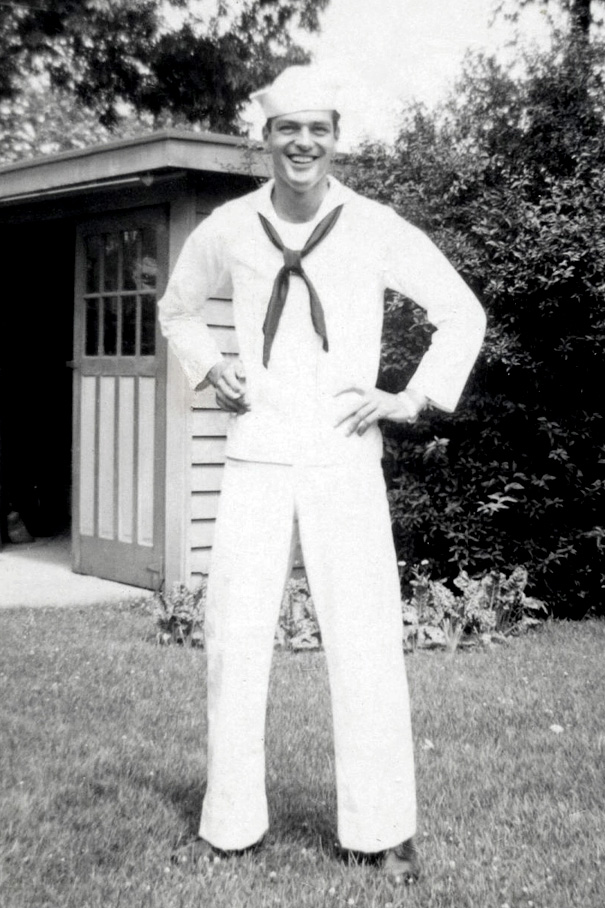
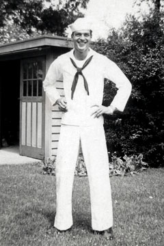
Ed smiles for photo taken at
family's home in 1945.
Three months after washout and discharge as an
A-V(N) Naval Aviator and Ensign, he was drafted back
by the Navy as an Apprentice Seaman. This was
typical for all naval aviation cadets who didn't
finish training, but Ed made it further than most
washouts. He once quipped, "I wanted wings till I
got them, then I didn't anymore." It didn't matter
that he was drafted back. He was undoubtedly
grateful having survived crashing his airplane. No
shame in being relegated to the rank of Seaman. |
From Ensign to Seaman
No longer a commissioned officer, Ed
was initially relegated to the rank of Apprentice Seaman. This was the typical practice for naval
cadets who "washed out" and did not complete all
aviation training before combat assignment.
Ed Scharch reported Jul 26, 1945 to the U.S.
Naval Training Center in Great Lakes, Illinois for
boot camp and to undergo physical training for a
second time.
Ironically, the surrender of Imperial Japan was
announced on August 15 and formally signed on
September 2, 1945, bringing the hostilities of World
War II to a close.
Two days later, Ed completed recruit training on
Sep 04, 1945. He also received gas mask drill &
chamber instruction, a course in fire fighting
school, rifle range instruction and night lookout
training. He was also qualified as a "third class"
swimmer. He was advanced to S2c (Seaman 2nd Class)
and granted 5 days recruit leave from Sep 04-09,
1945.
Despite the war's end and re-enlistment of two
more years, Ed remained in the service and spent the next seven months serving at
Naval Air Station Corpus Christi, Texas, where he
was transferred to on Oct 02, 1945. Ed reported on Oct
08, 1945 to Naval Auxiliary Air Station, Waldron
Field, Corpus Christi, TX, from USNTC Great Lakes,
IL. NAAS Waldron Field was built as a satellite
airfield in 1943 for nearby NAS Corpus Christi, and
it is where he was stationed for a duration of 4
months and 20 days.
There are no military records mentioning the type
of duty Ed performed at NAAS Waldron Field or NAS
Corpus Christi, which was one of the Navy's other
Intermediate flight training centers.
What were the duties of a NavCad Ensign
washout-turned S2/c at naval aviation station after
the war concluded?
Ed had a non-flying ground job at Waldron Field,
and he probably performed a multitude of menial tasks
in support of aviation training operations. He was
probably assigned to a variety of duties where lower
ranked Seaman were needed most.
After a few months Ed was transferred on Feb
28, 1946 to NAS Corpus Christi for "other duty." He
reported on Mar 02, 1946 and was stationed there for 26 days.
The military had already begun the great migration
of discharging service personnel and returning them
to civilian life and their families. Ed was sent
there for that purpose and was offered an early
discharge. The entry in his service record reads,
"3-20-46 Has been interviewed and does not wish to
reenlist in the U.S. Navy."
He was then transferred again on Mar 28, 1946 to the Naval
Personnel Separation Center, USNPSC Great Lakes, IL,
for discharge from the military. Two days later he reported to Great
Lakes to begin long process of discharge from
military. It took about two weeks to go through the
pipeline back to civilian life.
The discharge process included some exit
interview questions, including any preferences for
type of job and training provided by the new G.I.
Bill. The Notice of Separation From U.S. Naval
Service form showed Ed's job preference as "Aeronautical
Engineering, Middle West," with type of
training as "College
Training." WWII veterans became the first to be entitled to free
college education along with other perks.
On April 13, 1946, having served a total of 3
years and 27 days, S2/c Edward L. Scharch was
honorably discharged from the U.S. Navy Reserve
where he served for Uncle Sam during World War Two.
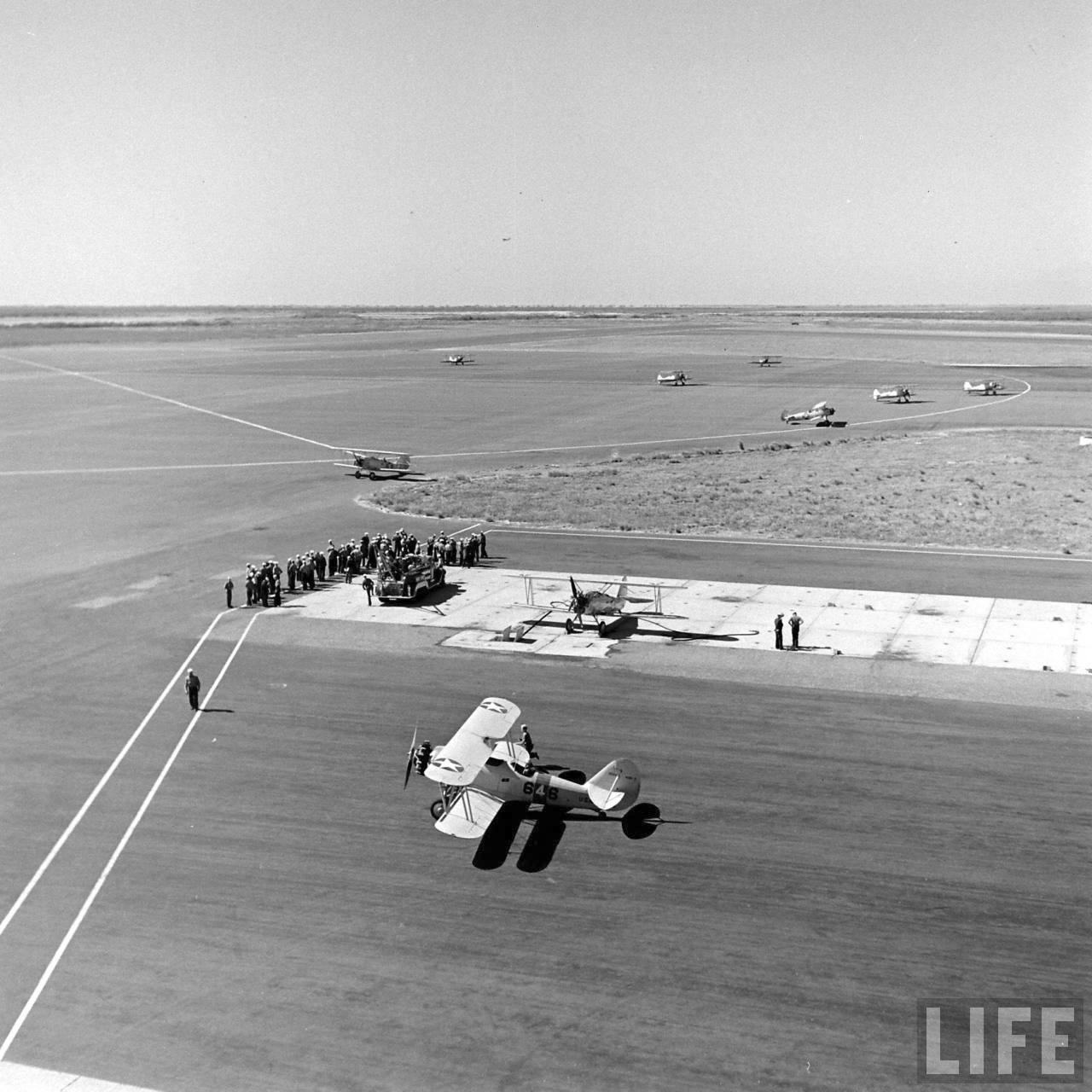
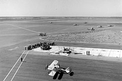
Edward shared one good yarn about the time he
served as a Seaman at NAS Corpus Christi. Even
though he was no longer an Ensign or navy pilot, Ed
decided one early morning to take off in navy
trainer on a mission for fellow ground crewman. He
volunteered to go on a donut run with an airplane.
Saying they had better donuts and one of Corpus
Christi's other outlying airfields, Ed flew the Navy
plane over to pick up a few dozen donuts at their
mess hall. He safely returned from his mission with
a booty of donuts for everyone!
|
|
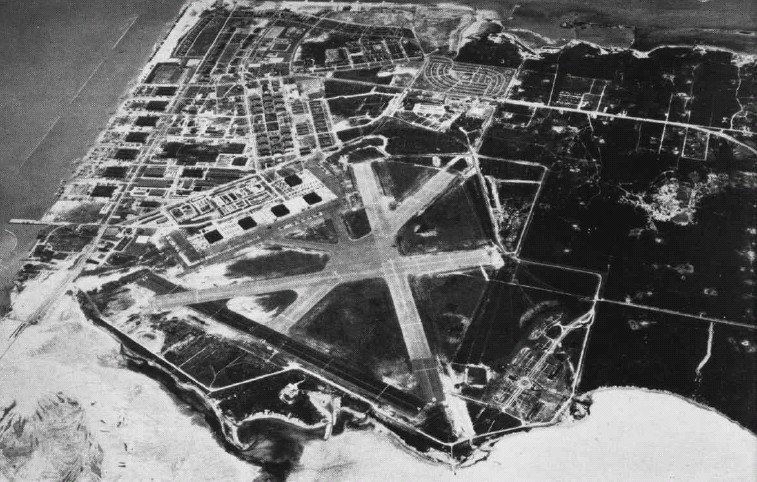
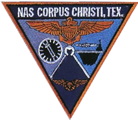
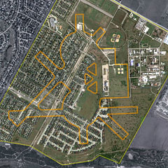
NAS Corpus Christi, Texas
|
 |
|
Naval air station patch |
|
|
 |
|
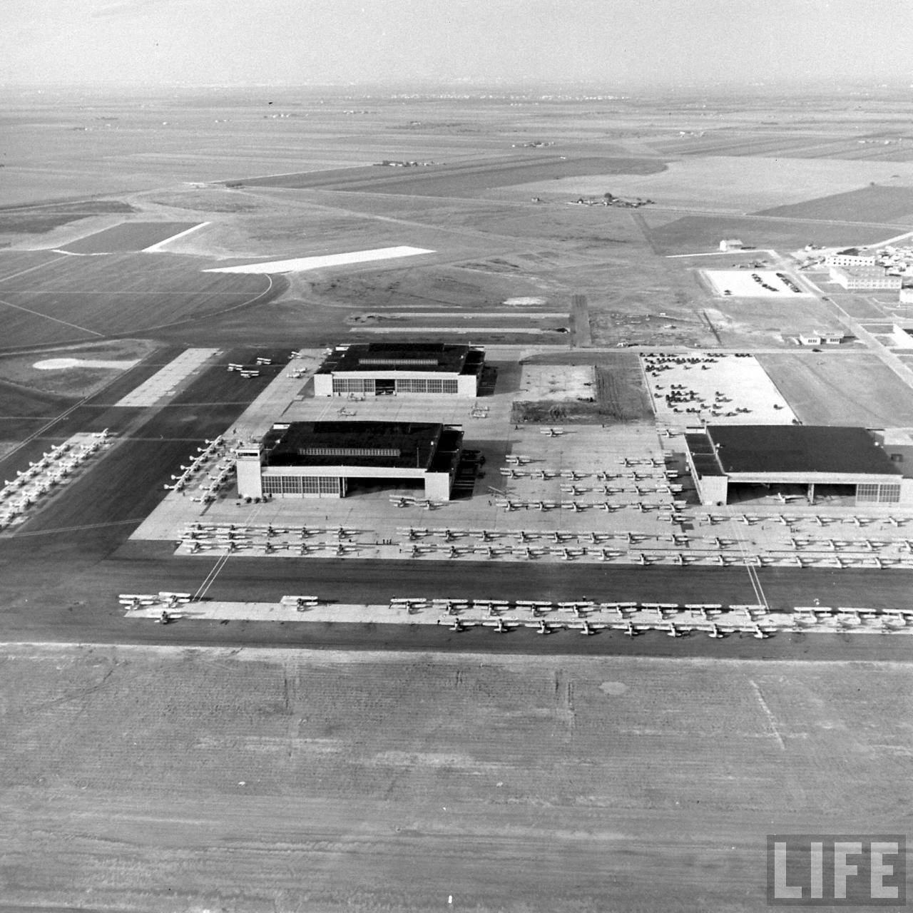
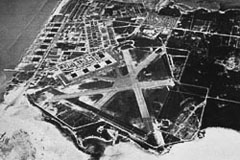
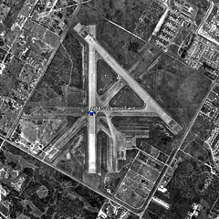
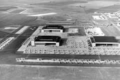
NAS Corpus Christ, Texas. ca 1946-1947 |
Naval Air Station (NAS) Corpus Christi, is a naval base located
six miles southeast of the central business district of
Corpus Christi, in Nueces County, Texas.
The official step leading to the construction of the
Naval Air Station was initiated by the 75th Congress in
1938. A board found that a lack of training facilities
capable of meeting an emergency demand for pilots
constituted a grave situation. They recommended the
establishment of a second air training station and that it
be located on Corpus Christi Bay.
NAS Corpus Christi was commissioned by its first skipper,
Captain Alva Berhard, on March 12, 1941. The first flight
training started on May 5, 1941.
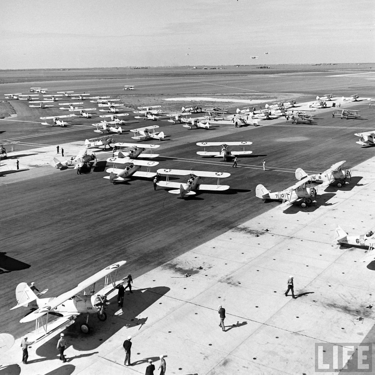
In 1941, 800 instructors provided training for more than
300 student pilots a month. The training rate nearly doubled
after the bombing of Pearl Harbor. By the end of World War
II, more than 35,000 naval aviators had earned their wings
there. Corpus Christi provided intermediate flight training
in World War II, training naval pilots to fly SNJ, SNV, SNB,
OS2U, PBY, and N3N type airplanes. Former
President George H.W. Bush was the youngest pilot to receive
his wings at NAS Corpus Christi in June 1943.
In 1944, Corpus Christi was the
largest naval aviation training facility in the world. The
facility covered 20,000 acres, and had 997 hangars, shops,
barracks, warehouses and other buildings. The Corpus Christi
training facility consisted of the main location and six
naval auxiliary air stations (NAAS) including Rodd, Cabaniss, Cuddihy,
Kingsville, Waldron, and Chase fields. Along with the six
auxiliary stations, were 25 naval outlying landing fields
(NOLF) dotting the
countryside, These NOLFs were used by naval air cadets to practice
their landings and takeoffs using Navy primary and
intermediate training aircraft.
NAS Corpus
Christi also was home to the Blue Angels from 1951-1954. It
also served as a Project Mercury Tracking station in the
early 1960s.
Today, the training program is much longer, approximately
18 months, due to the increased complexity of today's
aircraft. Currently, Training Air Wing FOUR produces
approximately 600 newly qualified aviators each year.
|
|
Sectional Aeronautical Chart (Jan
1945),
Corpus Christi, Texas |
|
(Opens in separate tab)
|
 |
|
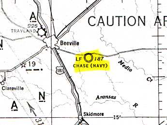
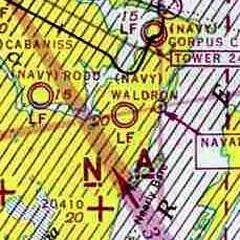
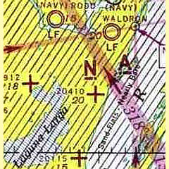
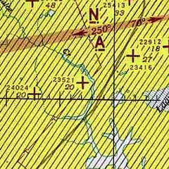
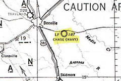
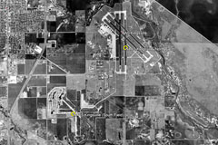
MAP LEGEND - Naval auxiliary
air stations (NAAS) are represented by yellow circles.
Landing fields have "+" symbol and
5-digit number. |
|
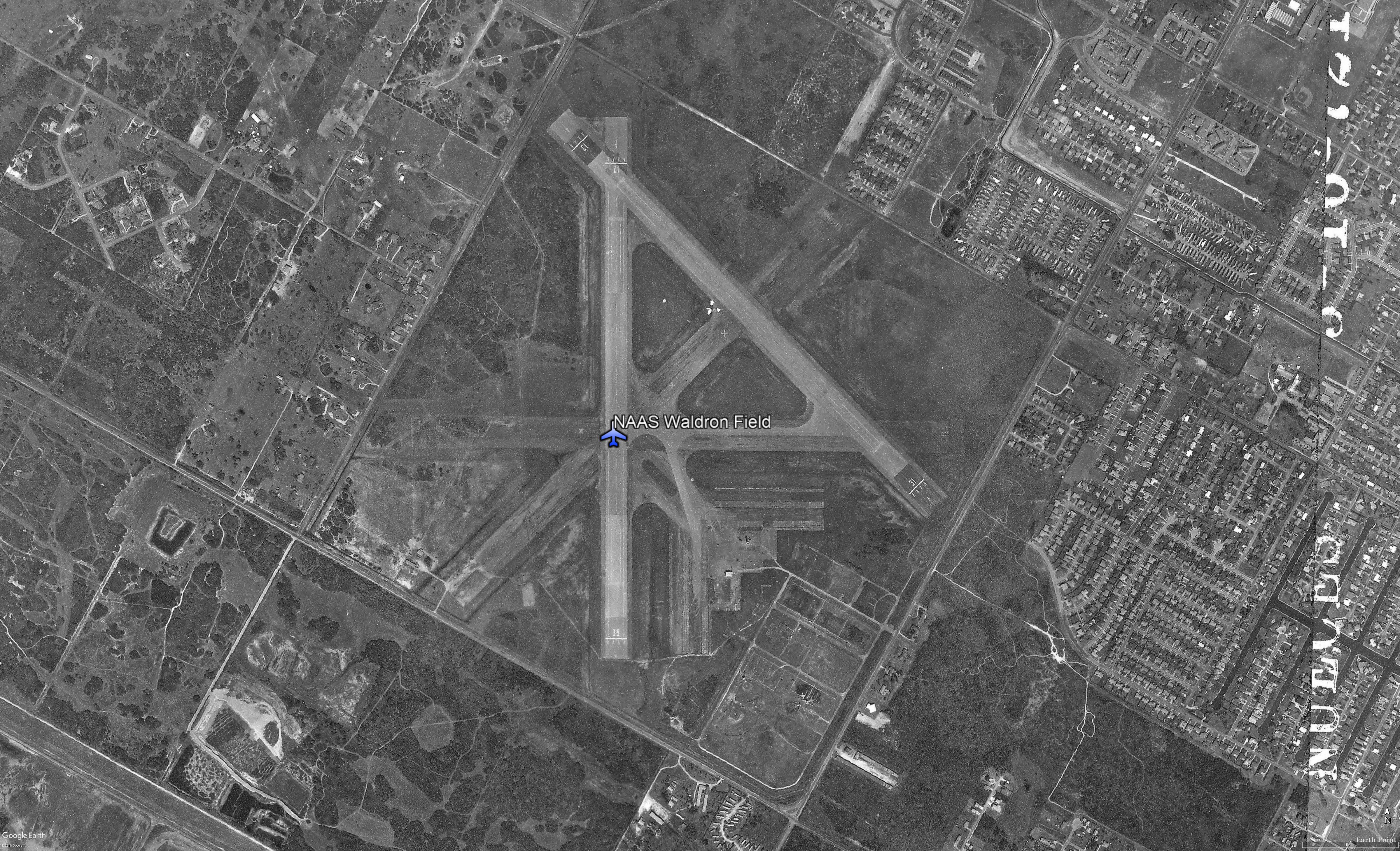
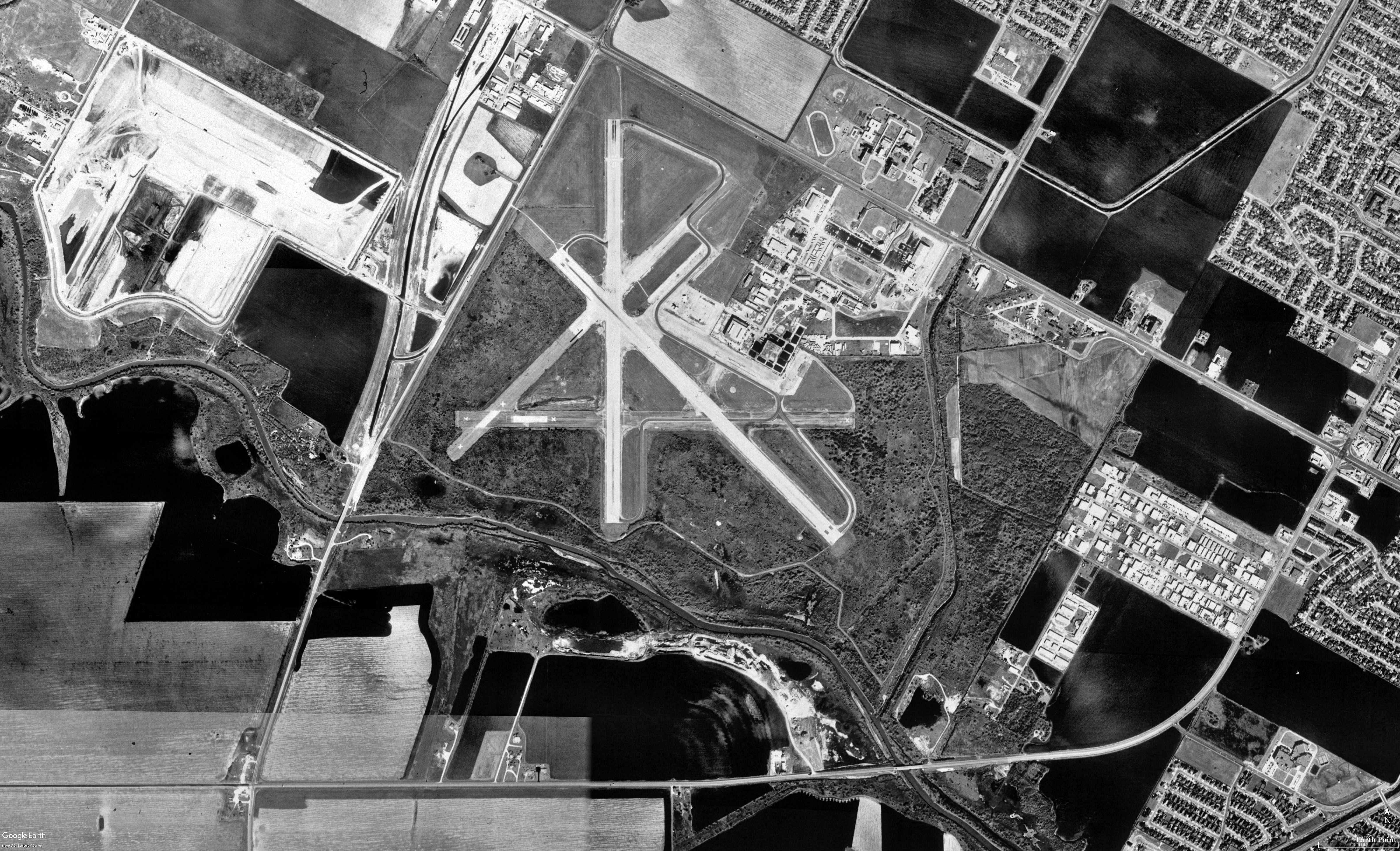
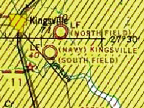
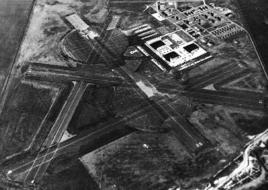
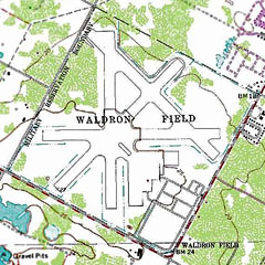
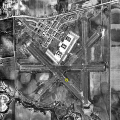
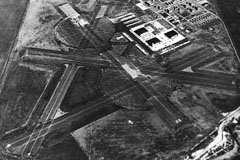
Ed was stationed at NAAS Waldron Field (orange highlight)
from 8-Oct-1945 to 28-Feb-1946. This chart shows a major
portion of NAS Corpus Christi, Texas.
|
U.S. Coast And Geodetic Survey, United States Federal
Aviation Administration, and National Ocean Survey.
Sectional aeronautical charts: United States.
Washington, D.C.: U.S. Coast and Geodetic Survey, 1927. Map.
https://www.loc.gov/item/2009582532/. |
|
|
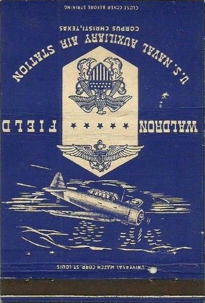
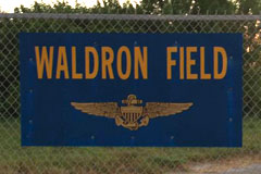
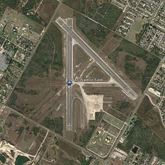
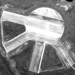
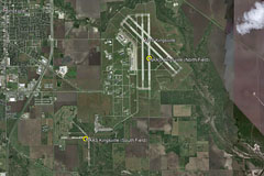
NAAS Waldron Field
(Corpus Christi, Texas)
Coordinates: 27.56 North / 97.34 West,
(27.633638, -97.315392)
|
|
 One of the largest naval air station projects of
1943 included expansion at NAS Corpus Christi, Texas, and two of its
four existing auxiliary stations, and the establishment of
two new auxiliary fields. One of the new auxiliary fields
was NAAS Chase at
Beeville, Texas, and the was Field 21305 (later named NAAS Waldron Field),
located near the main station at Corpus Christi. One of the largest naval air station projects of
1943 included expansion at NAS Corpus Christi, Texas, and two of its
four existing auxiliary stations, and the establishment of
two new auxiliary fields. One of the new auxiliary fields
was NAAS Chase at
Beeville, Texas, and the was Field 21305 (later named NAAS Waldron Field),
located near the main station at Corpus Christi.
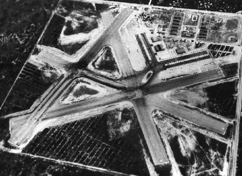
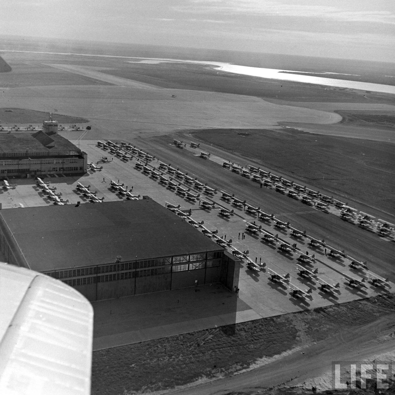
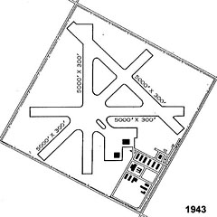
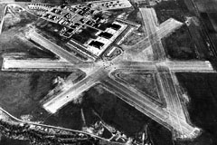
Waldron Field
(21305), the smaller of the two new stations, was similar in
size and function to the original three auxiliary fields
adjacent to NAS Corpus Christi. Initial construction at
Waldron consisted of quarters for 450 enlisted men and
260 cadets, and a hangar.
|
|
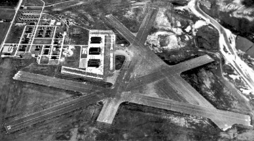
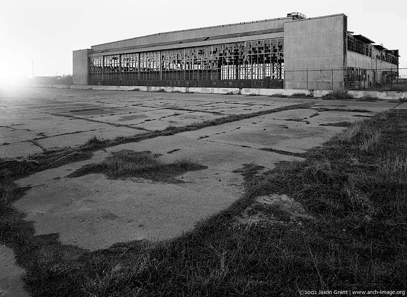
Naval Auxiliary Air Station Waldron Field was
built in 1943 as part of the NAS Corpus Christi,
Texas complex, and was one
of six auxiliary air station satellites. Located 3.5 miles southwest
of the main air station, Waldron provided training
in torpedo bombers during WWII.
Waldron Field was named in honor of LCDR John
Charles Waldron (August 24, 1900 – June 4, 1942), a
United States Navy aviator who led a squadron of
torpedo bombers in World War II. John Waldron and
most of his squadron perished in the Battle of
Midway.
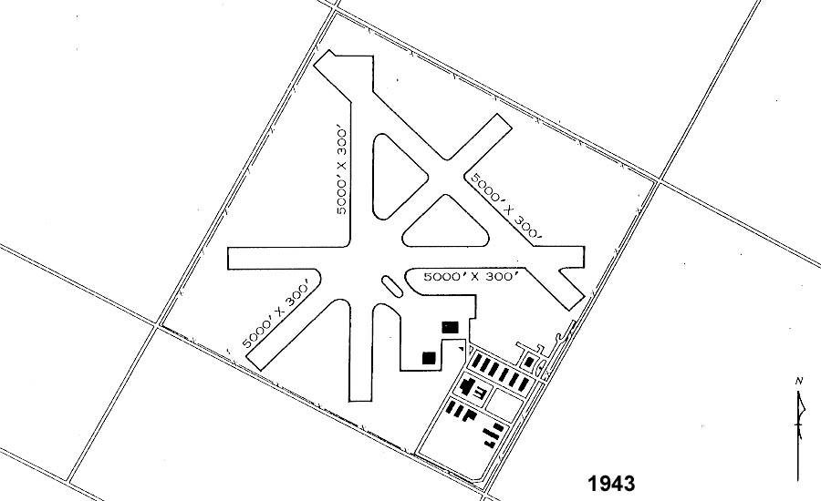
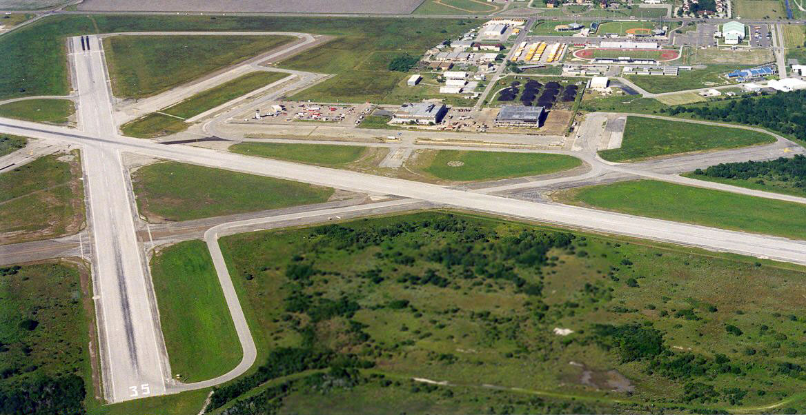
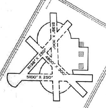
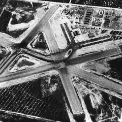
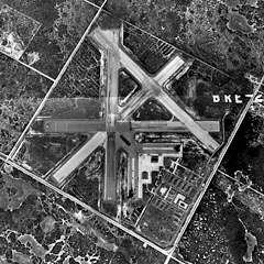
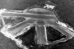
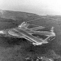
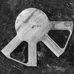
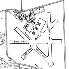
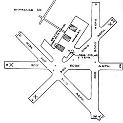
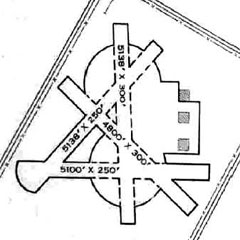
A 1945 AAF Airfield Directory described Waldron Field
as a 640 acre square-shaped field having four bituminous
5,000 foot long runways. The field was described as having
two wooden hangars measuring 192 feet by 125 feet.
Waldron
was listed as having a total of 4 outlying landing fields
used for training aviation cadets.
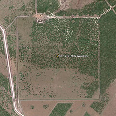
| 21917
NOLF #12 (12 mi SW) |
|
23425 NOLF #15 (20 mi SW) |
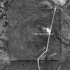
| 23521 NOLF #13 (15
mi SW) |
|
20410
NOLF #41 (5 mi SSW) |
|
Sectional Charts, Maps, and Aerial Photos
|
|
The earliest depiction of NAAS Waldron Field was on the July 1943 Corpus Christi
Sectional Chart.
A 1944 aerial view
looking southeast at Waldron Field shows the airfield having
four
paved runways, large ramps, and two large hangars. It was
still depicted as an active airfield on the 1949 Corpus
Christi Sectional Chart and described as having a 5,000'
hard-surface runway.
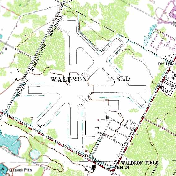
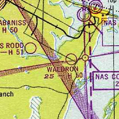
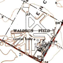
The 1951 USGS topo
map depicted Waldron Field as having four paved runways, a control
tower, and numerous buildings.
Waldron was evidently closed at some point between 1951-64, as
it was labeled "Aband airport" on the 1964 Corpus Christi
Sectional Chart.
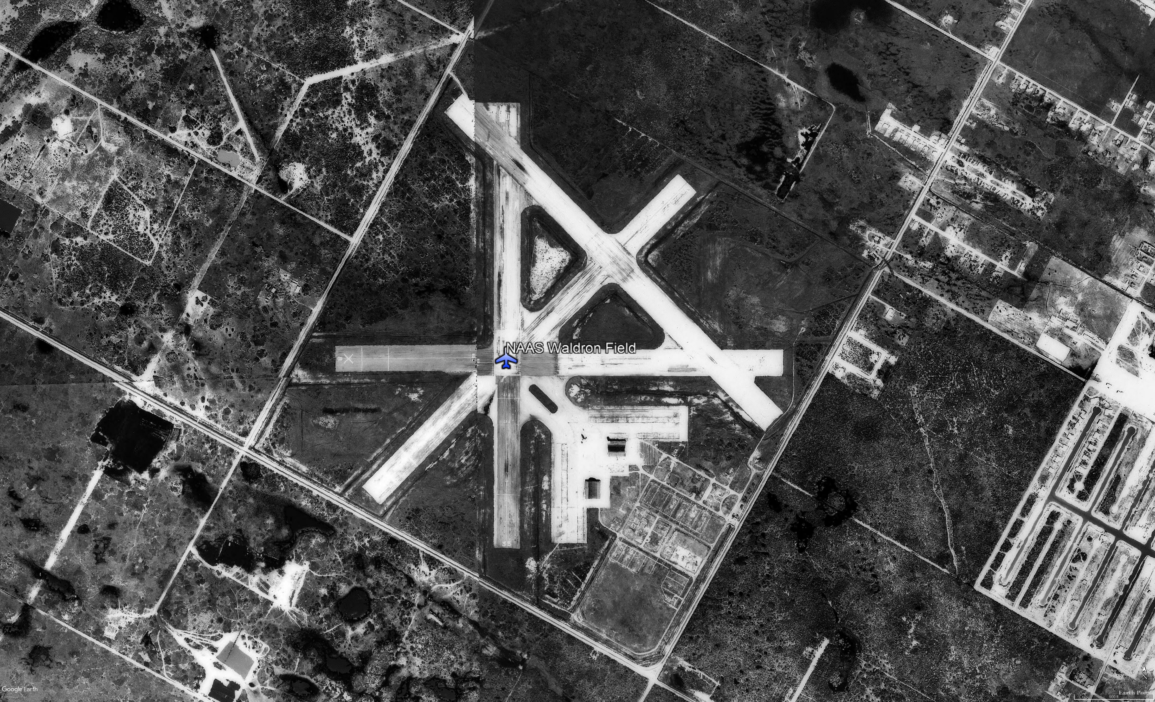
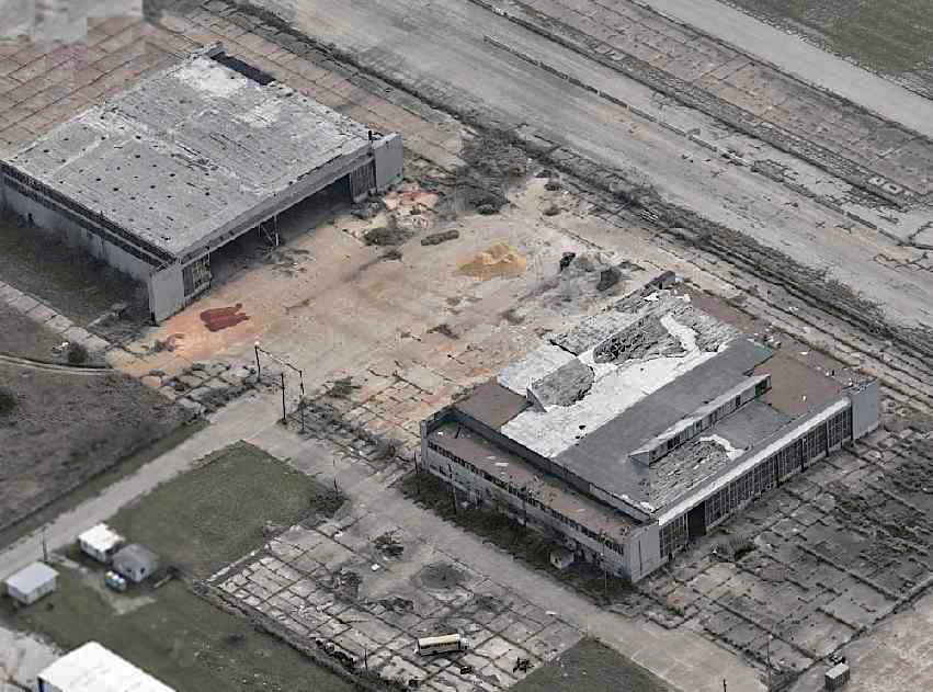
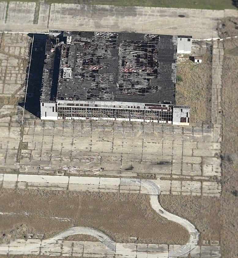
A 1967 aerial photo showed the southern hangar had been
removed at some point between 1945-1967, along with most of the
smaller buildings to the southeast. However, the field
was brought back into limited use by the U.S. Navy between 1964-69 as an Outlying Field for NAS Corpus Christi,
"OLF Waldron (Navy)," was once again depicted as an active
airfield on the July 1969 Brownsville Sectional Chart.
Source:
http://www.airfields-freeman.com/TX/Airfields_TX_CorpusW.htm#waldron
|
 |
 |
 |
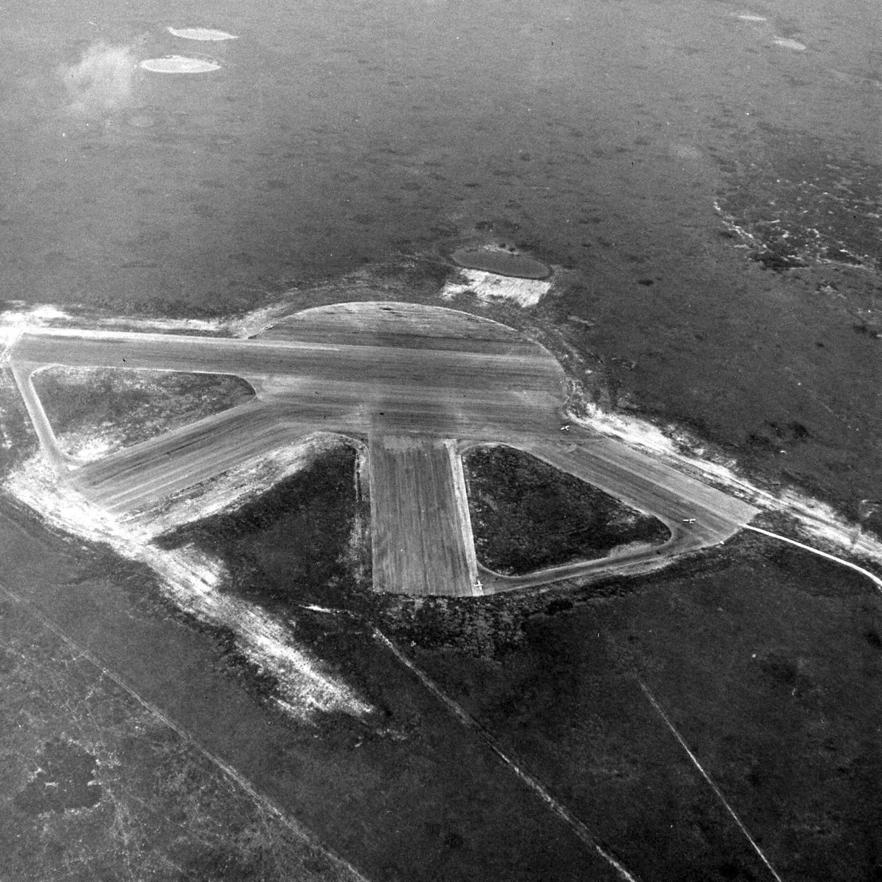
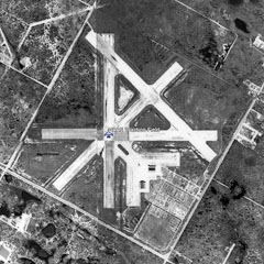
NAAS Waldron Field
Elevated
view looking SE in
1944 |
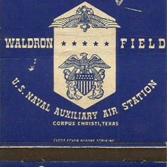
NAAS Waldron Field
Souvenir
matches from 1940s |
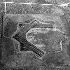
NAAS Waldron
Field
Diagram from 1943
AAF Directory of Waldron |
| |
|
|
 |
 |
 |
NAAS Waldron Field
Sectional
Aeronautical Chart Jul-1943 |
NAAS
Waldron Field
Sectional Aeronautical
Chart 1949 |
NAAS Waldron
Field
USGS Topographic Map 1951 |
| |
|
|
 |
 |
 |
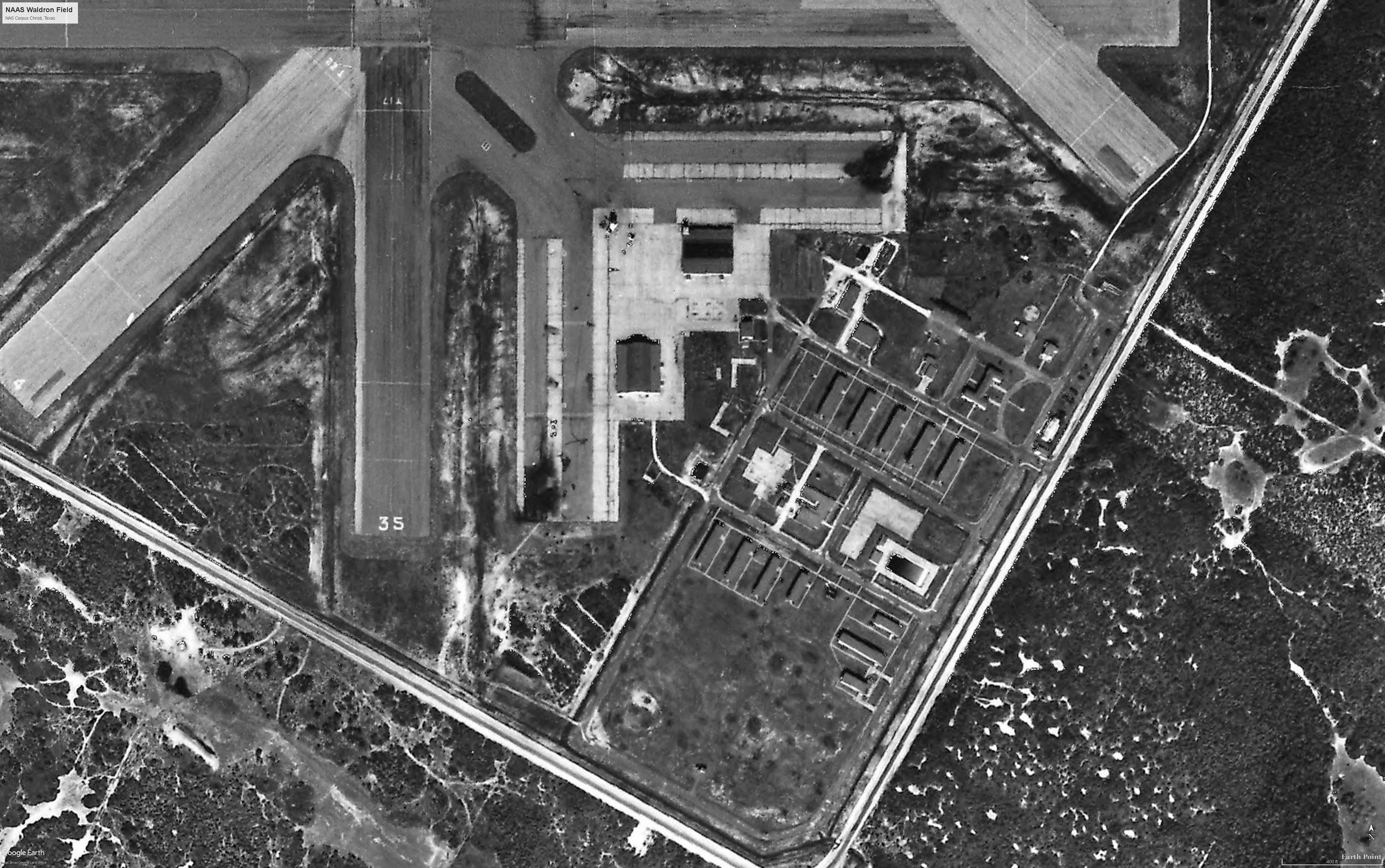
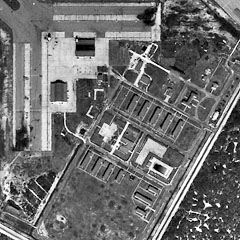
NAAS Waldron
Field
Aerial photo Dec-1956 |
NAAS Waldron
Field
Buildings,
hangars, and barracks, Dec-1956 |
NAAS Waldron
Field
Aerial photo
Dec-1961 |
|
|
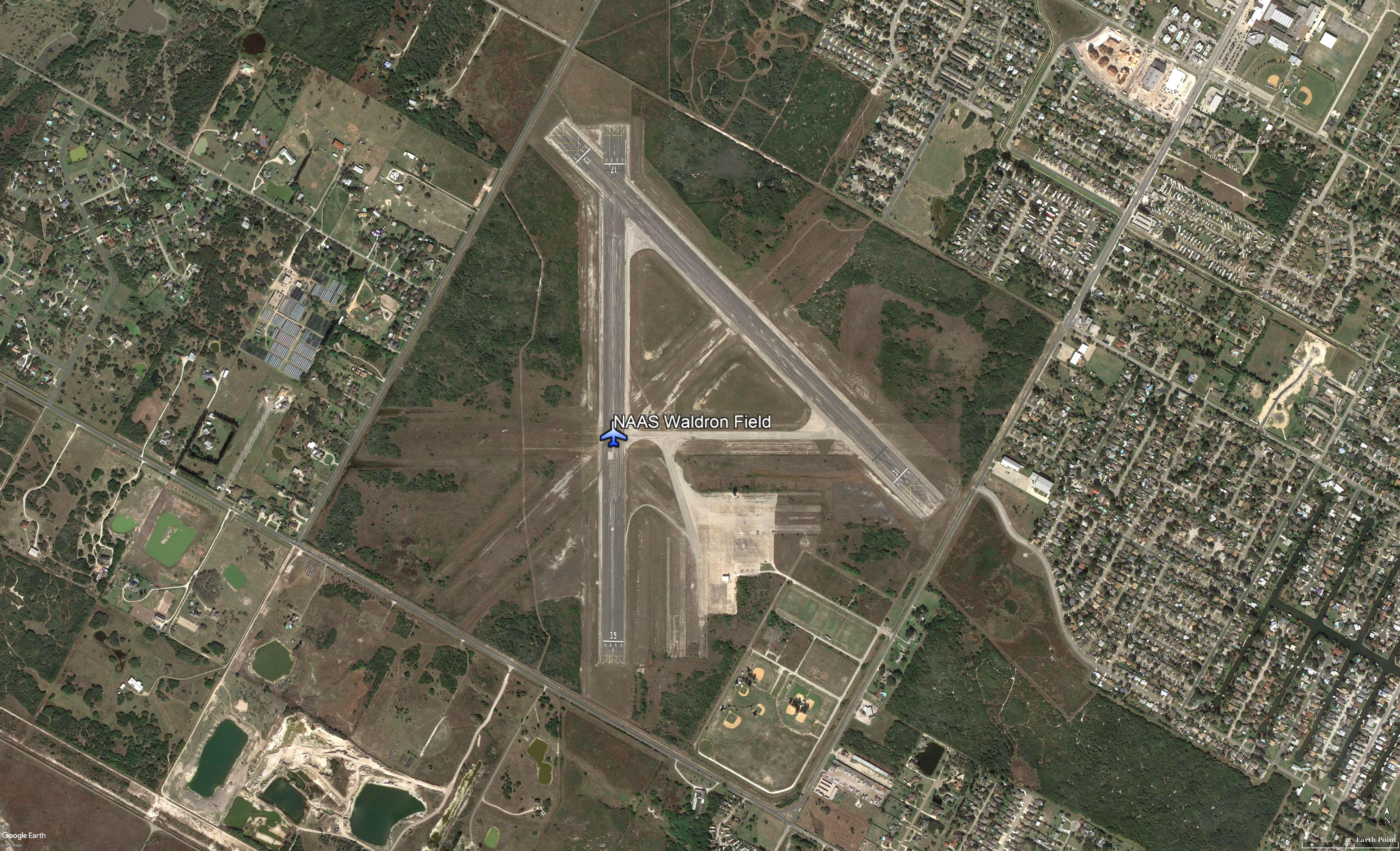
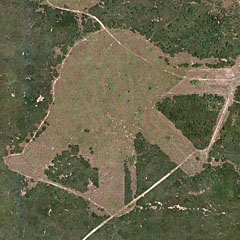
The 1989 USGS topo
map depicted Waldron Field as having 4 paved runways. The last
hangar had been removed at some point between 1967-89. The 1995 USGS aerial
photo showed that 2 of Waldron's runways were still maintained
(with the primary runway being 5,000'), while 2 others had been
abandoned but were still discernible. Both hangars were gone,
the ramps being completely clear.
In 2001, USNR LtJg. R.E. Hight
reported that Waldron was still used as a NOLF for NAS
Corpus Christi. No squadrons were based there, but T-34
Turbo
Mentors used
the field to practice touch-and-go's. |
 |
 |
 |
NAAS Waldron
Field
Aerial photo
Dec-1985 |
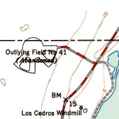
NOLF 20410 (Field #41)
Topographical Map
1989 |
NAAS Waldron
Field
Aerial photo
Jan-2017 |
|
|
|
Naval Outlying Landing Fields (for NAAS Waldron Field)
|
|
What's
a NOLF? |
|
A Navy Outlying Landing Field (NOLF) is a practice
field for training aviation cadets. These are minimal facilities
consisting of turf or paved landing pads and/or
runways, and they have
no based units or aircraft. They are located within isolated
areas of naval air station complexes, where air
traffic is lower and restricted by the military. The
remote locations of the NOLF reduces the risks and distractions
of other traffic at
a naval air training station or other airport.
|
|
NOLF #41 (20410) and others |
|
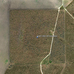
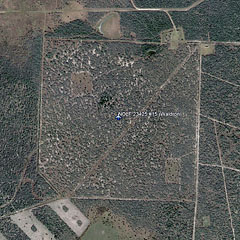
#12 (21917), #13 (23521), #15 (23425) |
 |
|
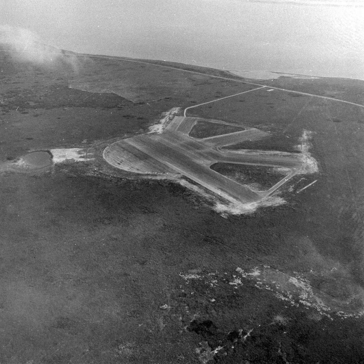
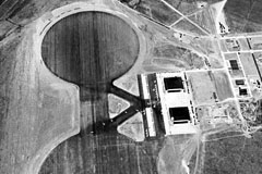
NOLF #41 (20410) looking northwest, with three
intermediate training planes on field. Dec-1942 |
NOLF #41 "20410", as depicted on the
July 1943 Corpus Christi Sectional Chart. This field was one of
a large number of satellite airfields built during WW2 to
support Navy flight training in the Corpus Christi area. The
date of construction is unknown. The earliest depiction of the
field which has been located was on the July 1943 Corpus Christi
Sectional Chart. Like many other WW2-era Corpus Christi area
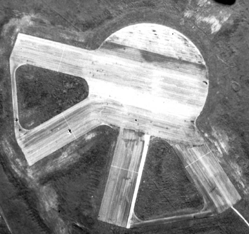
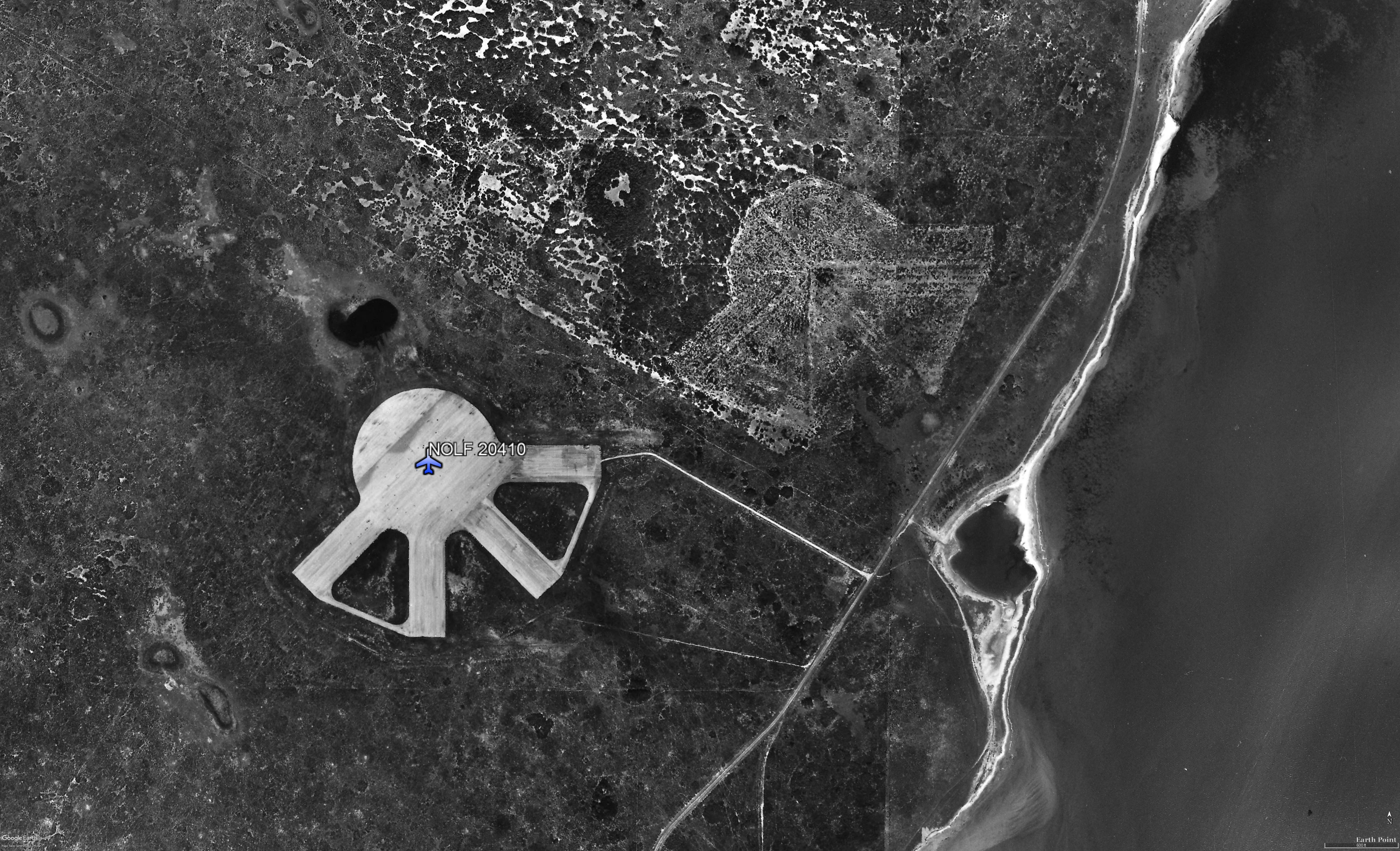
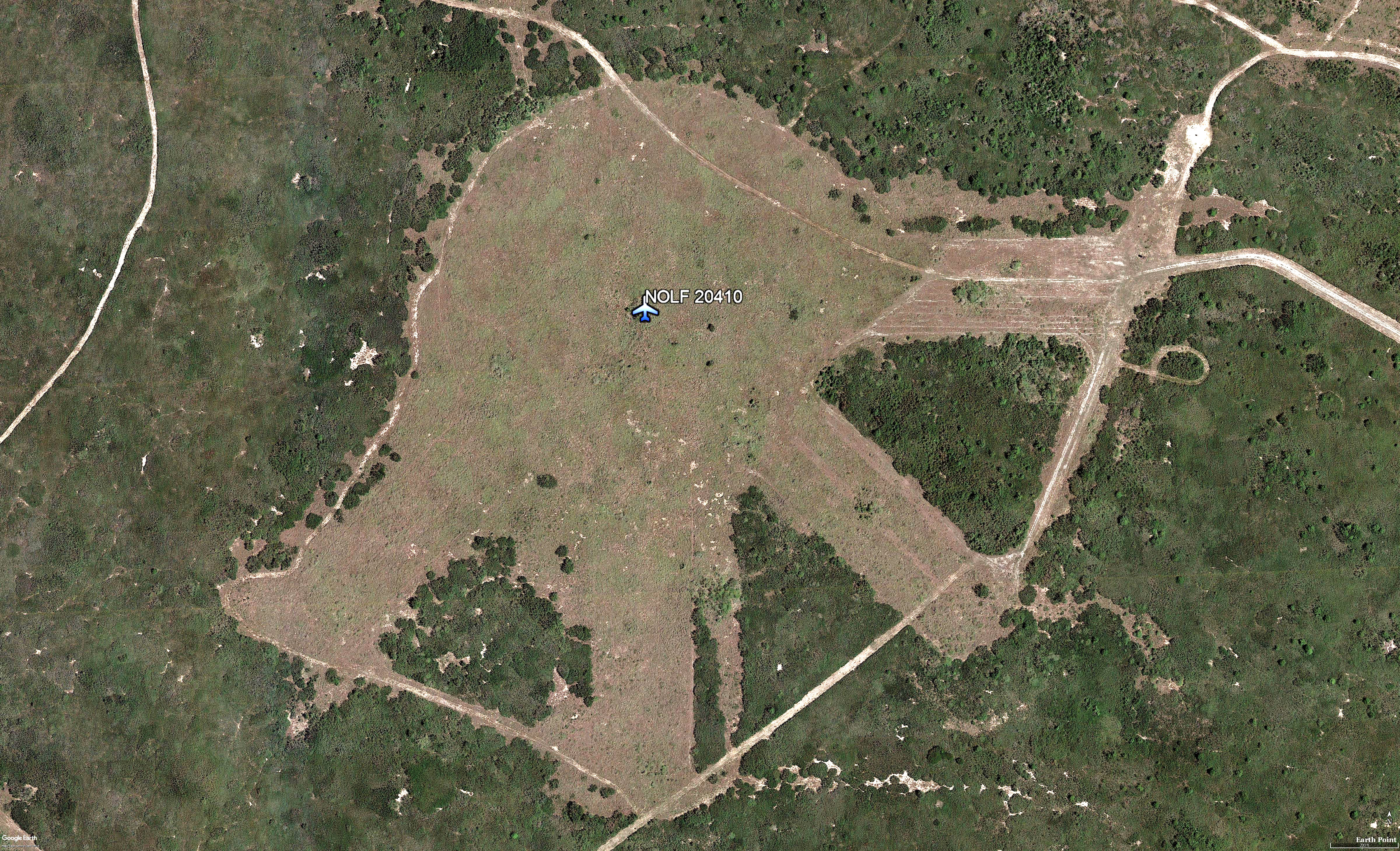
auxiliary airfields, NOLF 20410 consisted of a 1,200' diameter
circular landing mat, from which extended a total of four 2,000'
runways.
The field was apparently abandoned
by the Navy at some point between 1943-49, as it was not
depicted at all (even as an abandoned airfield) on the 1949
Corpus Christi Sectional Chart or the 1969 USGS topo map.
The outline of the circular mat &
runways were still quite recognizable in the
1995 USGS photo. It is located in a very
undeveloped area of the Texas coast, six miles south of Waldron
NOLF.
|
 |
 |
 |
NOLF #41 (20410)
Elevated
view looking east, Dec-1942 |
NOLF #41 (20410)
Sectional
Aeronautical Chart 1943 |
NOLF #41 (20410)
Planes on
field (North at 2:00), 10-Jan-1945 |
| |
|
|
 |
 |
 |
NOLF #41 (20410)
1951
Topographical Map |
NOLF #41 (20410)
Aerial of
field, 3-Mar-1956 (North is at 12:00) |
NOLF #41 (20410)
Aerial of
field, Aug-2017 |
| |
|
|
| |
|
|
 |
 |
 |
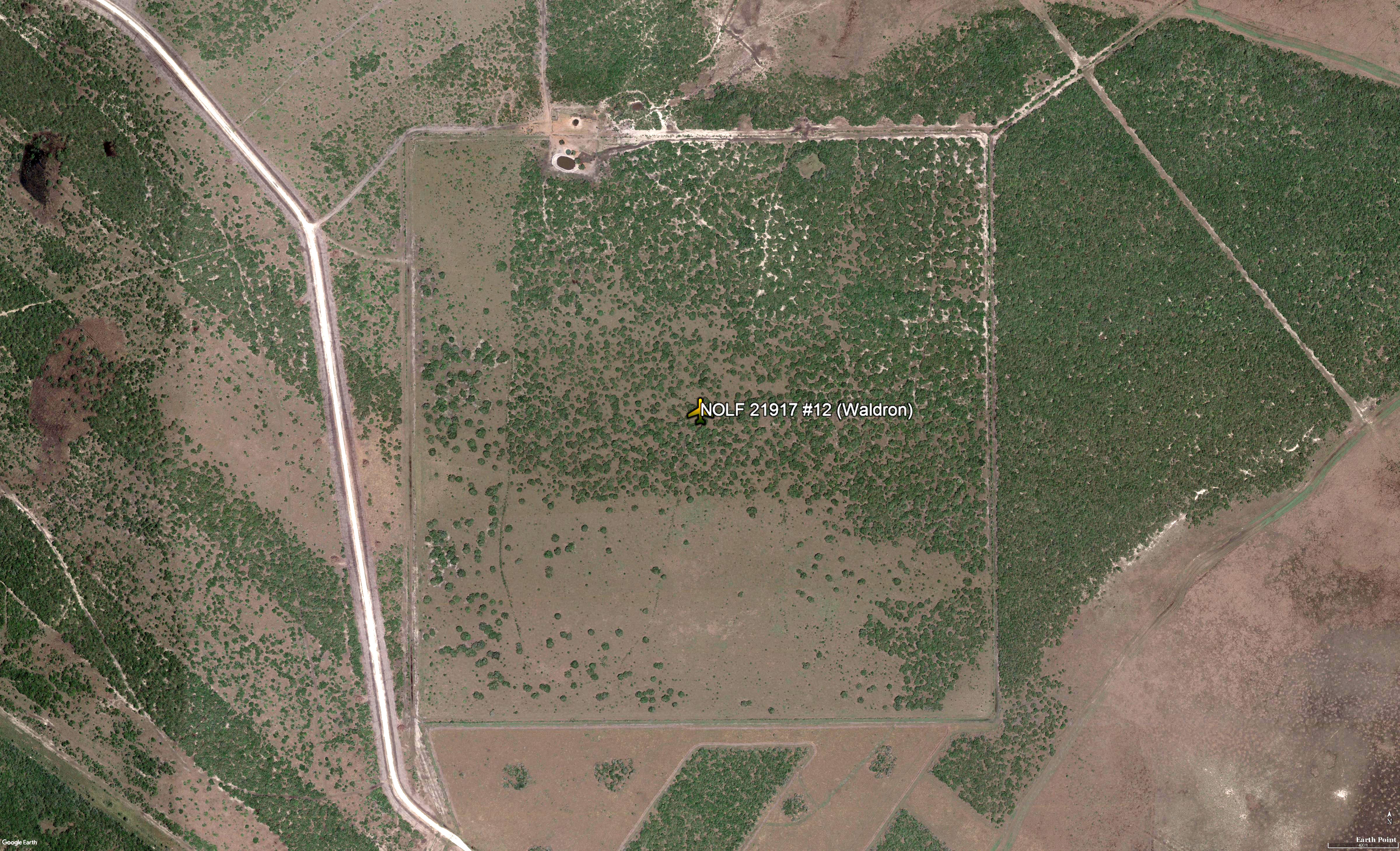
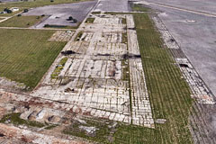
NOLF #12 (21917)
Former
airfield and overgrowth, Aug-2017. |
NOLF
#13 (23521)
Sectional Aeronautical Chart
1943 |
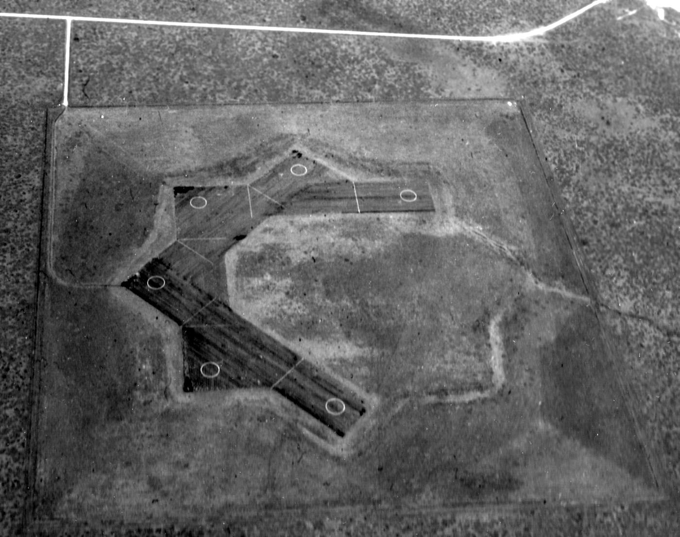
NOLF
#13 (23521)
Elevated photo
9-Jan-1945 |
| |
|
|
 |
 |
 |
NOLF
#13 (23521)
Aerial photo
Jan-1995 |
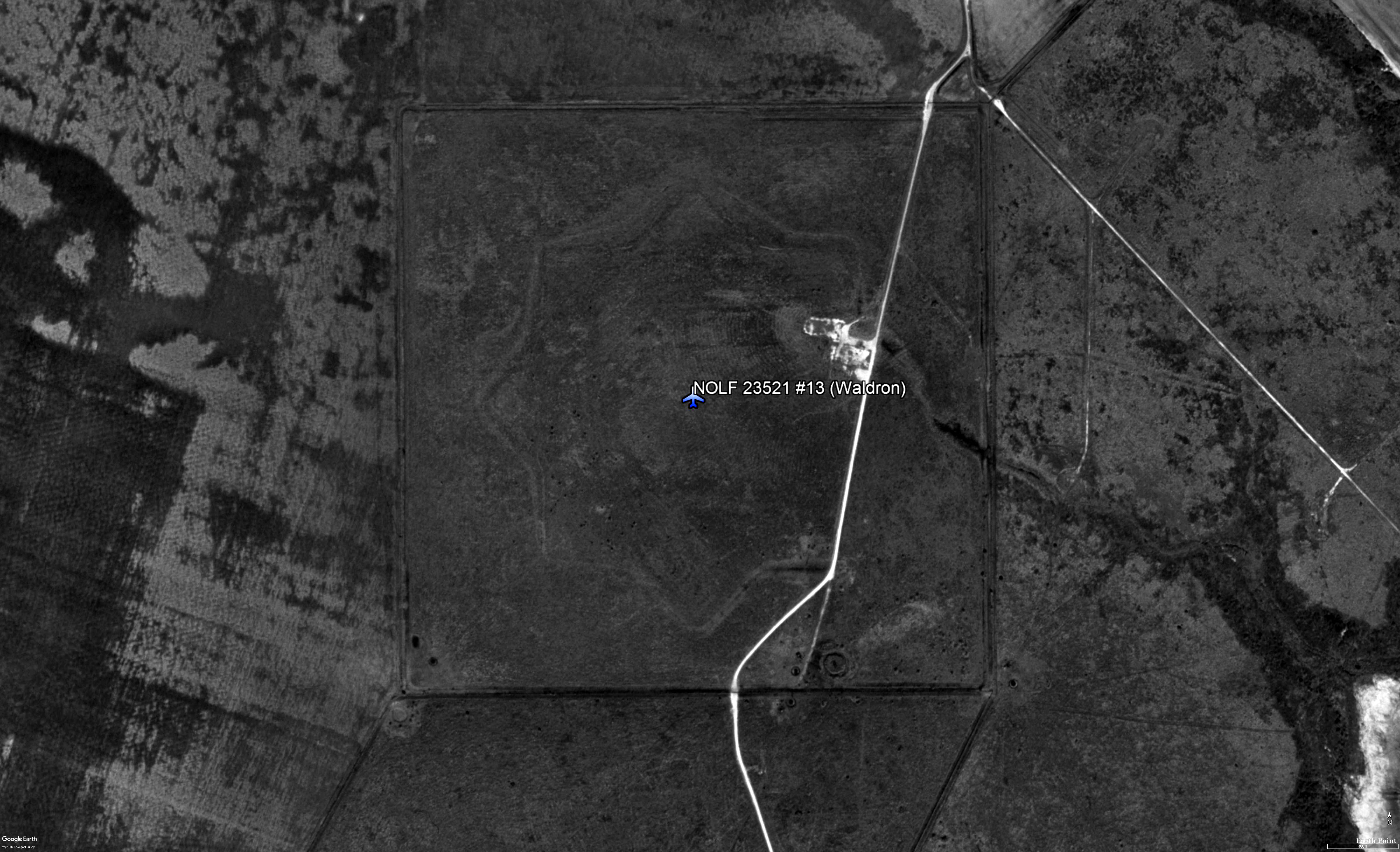
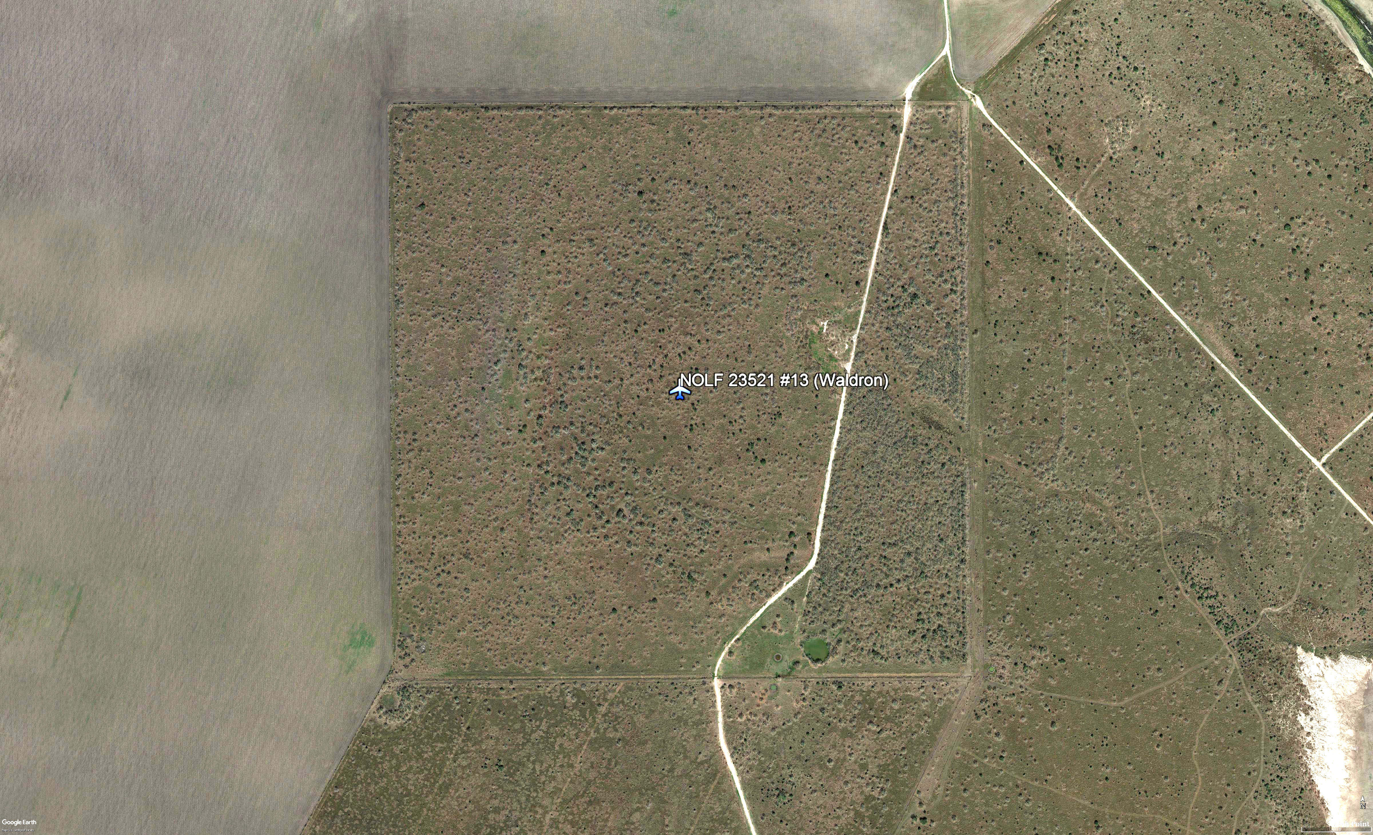
NOLF
#13 (23521)
Aerial Jan-2017 with
star pattern slightly seen |
NOLF
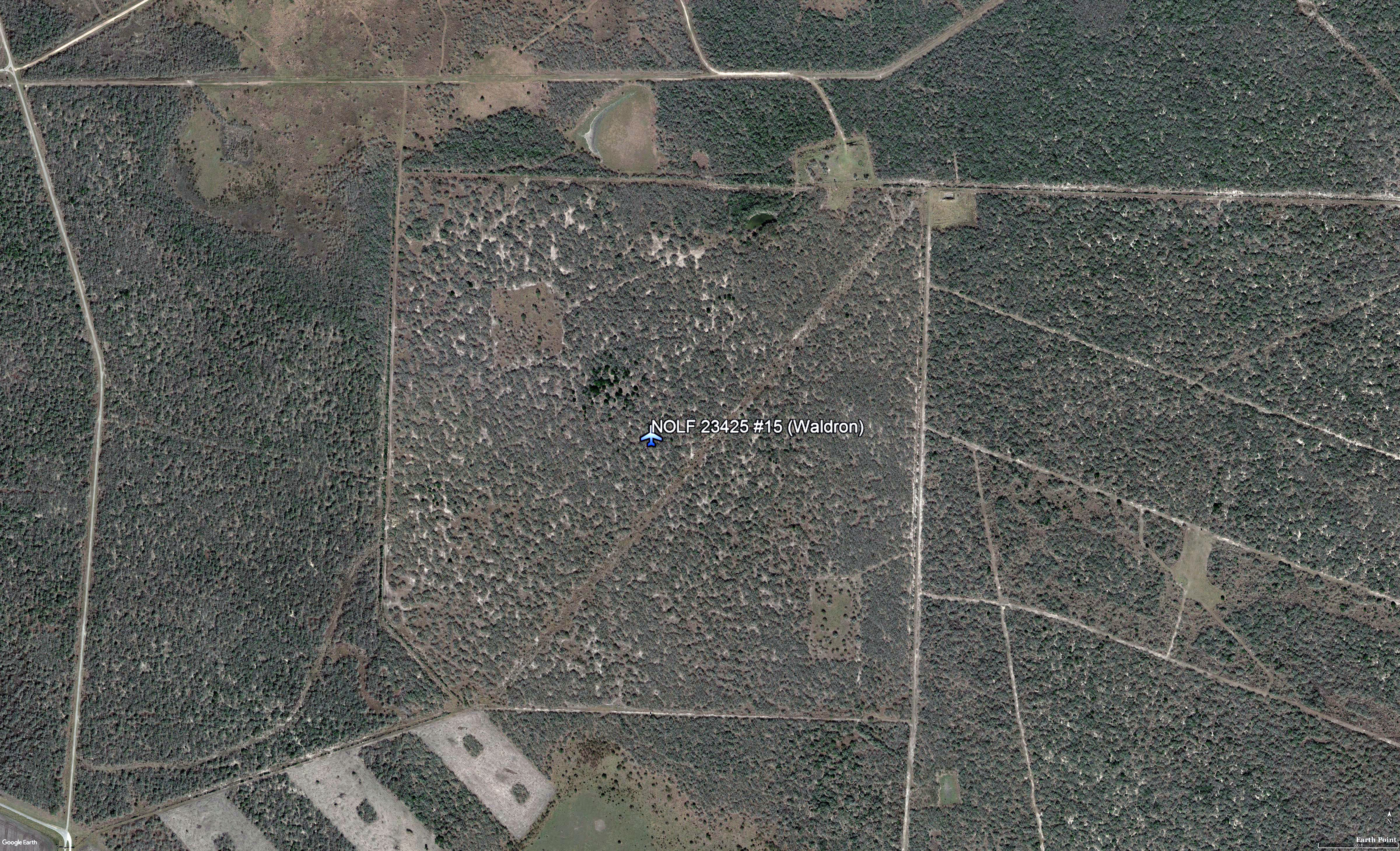
#15 (23425)
Aerial photo
Jan-2017 |
|
|
|
|
|
|
Corpus Christ's other Naval Auxiliary Air Stations
Cabaniss, Chase, Cuddihy, Kingsville, and Rodd
|
|
|
| While stationed at NAAS Waldron Field, Dad said he took off
in a trainer (without checking out), to get "better" donuts
from another auxiliary station nearby. He did not mention
the neighboring NAAS where he made pickup on his
ultimate donut run. That said, below are the other
five auxiliary air stations at NAS Corpus Christi,
Texas. |
|
|
|
|
|
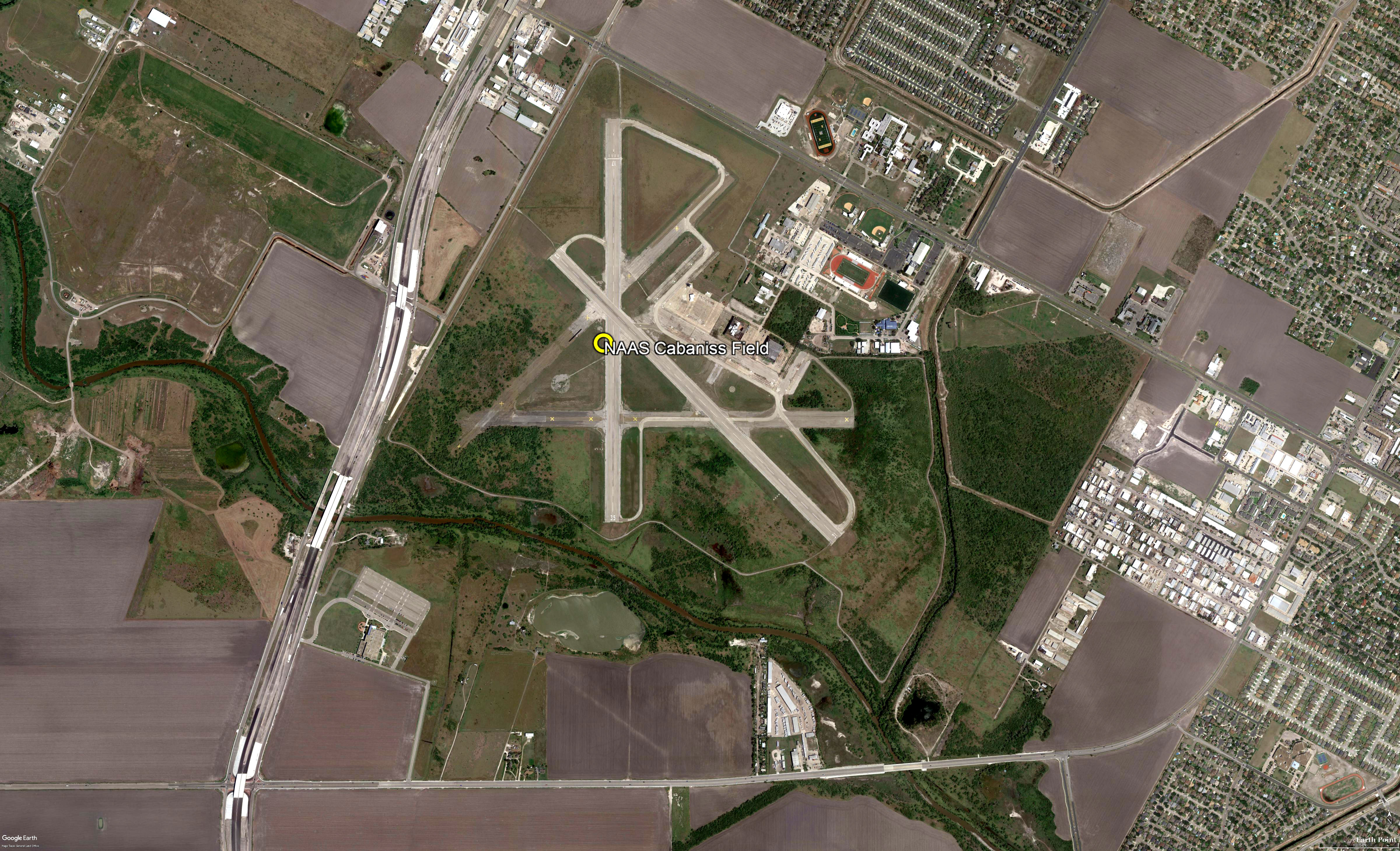
|
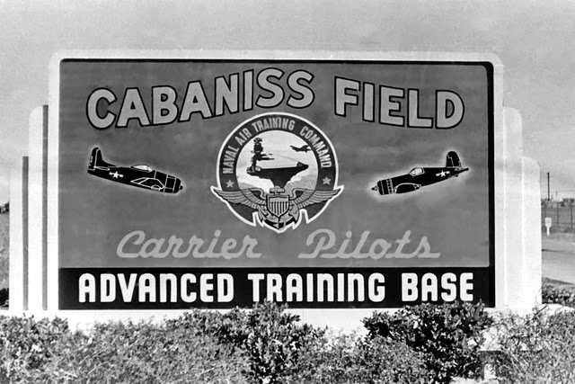
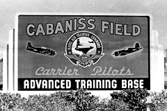
NAAS Cabaniss Field |
|
27.7, -97.44 (Southwest of
Corpus Christi) |
|
|
 |
|
Entrance sign to NAAS
Cabaniss Field ca. 1949 |
|
|
 |
| A 1941 elevated view looking NE at Cabaniss
Field while it was still under construction. |
| |
 |
| A 1943 elevated view looking east at
Cabaniss Field (National Archives photo) |
|
|
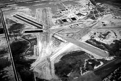
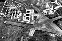
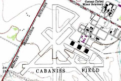
Cabaniss Field was built in 1941 as one of 3
satellite airfields for the nearby Corpus Christi
Naval Air Station, which conducted primary &
advanced flight training for American cadets &
those of several foreign countries.
The earliest
depiction which has been found of Cabaniss Field
was a 1941 aerial view looking northeast,
showing the field while it was still under
construction. Four runways had been graded &
partially paved, and 2 hangars were under
construction.
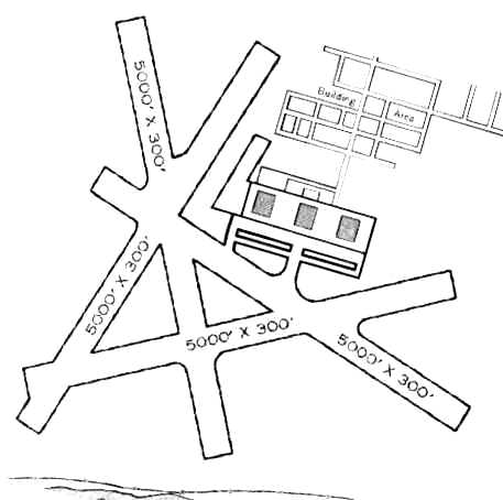
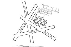
The 1945 AAF Airfield Directory (courtesy of
Scott Murdock) described Cabaniss Field as a
1,003 acre irregularly-shaped field having 4
asphalt 5,000' runways. The field was described
as having 3 steel 100' x 28' hangars.
Cabaniss was listed as having a total of 10 Naval
Outlying Landing Fields.
| 25117 NOLF #2A (8.2
SW) |
|
26117 NOLF #21 (6.7 mi WSW) |
| 25519 NOLF #2B (10 mi SW) |
|
26122
NOLF #22 (11 mi WSW) |
| 24823 NOLF #2C (14 mi SW) |
|
24720 NOLF #23 (11 mi SW) |
| 25824 NOLF #2D (14 mi WSW) |
|
25326
NOLF #24 (16 mi WSW) |
| 25413
NOLF #20 (4.7 mi SSW) |
|
25930 NOLF #26 (20 mi WSW) |
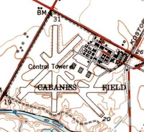
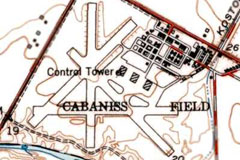
The 1951 USGS topo map depicted Cabaniss
Field as having 4 paved runways, 3 hangars, a
control tower, and numerous buildings. All of the airfield's buildings remained standing in
1958.
Cabaniss was evidently closed by the Navy at some
point between 1960-64, as the 1964 Corpus Christi
Sectional Chart described the field as "permanently
closed". At some point after 1964, Cabaniss was reopened
as a satellite airfield for Navy use.
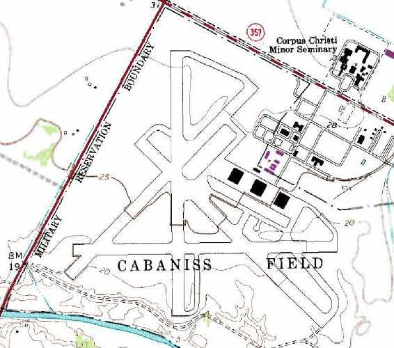
“Cabaniss Field”, as depicted on the 1975 USGS topo
map. A large number of the buildings to the northeast of
the airfield had been removed at some point between
1951-75.
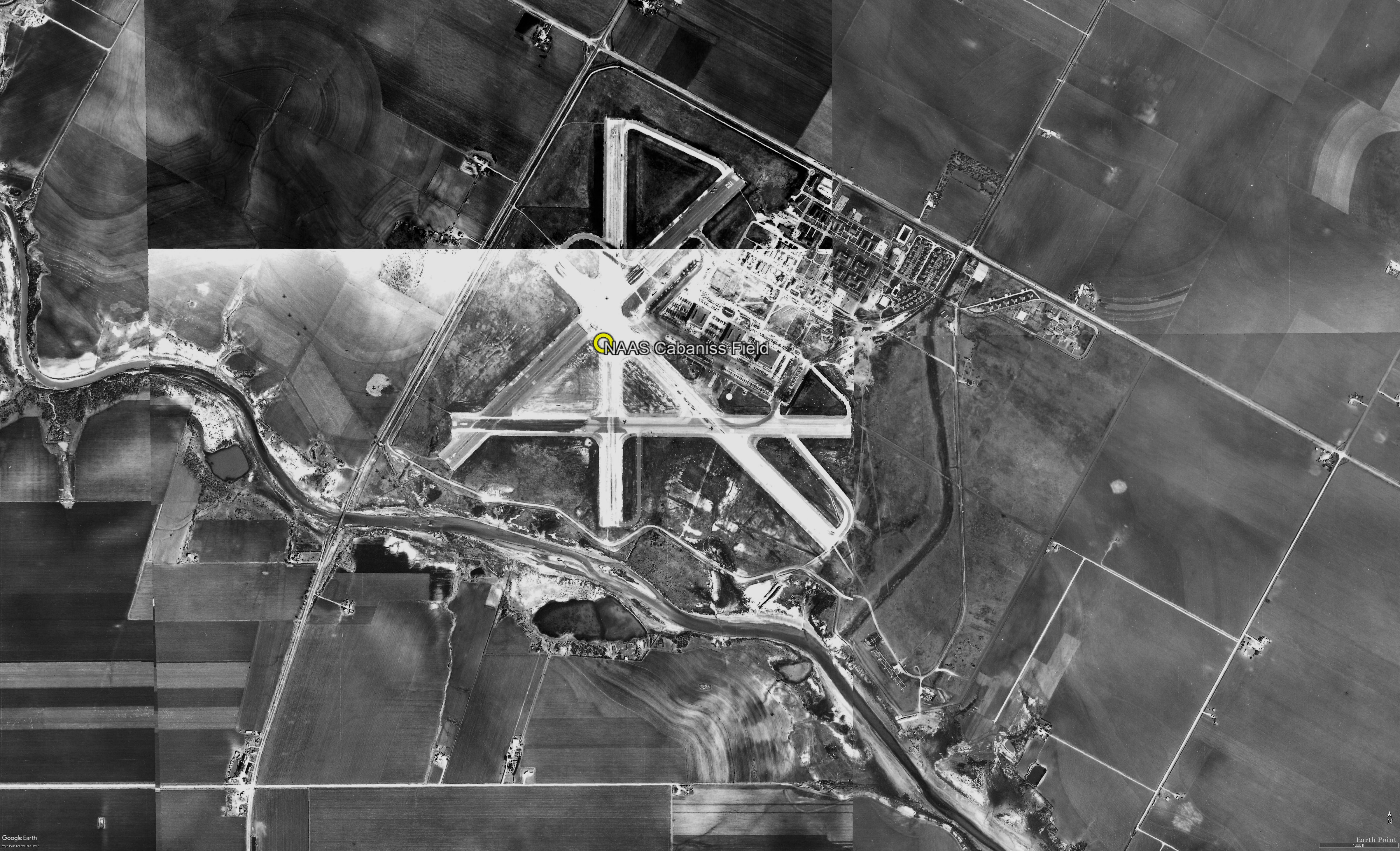
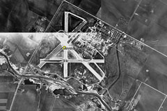
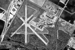
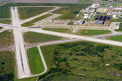
As of 2003, a total of 4 runways still remained at
Cabaniss. Runways 13/31 & 17/35 were still operational
(both 5,000'), and Runway 13/31 was lighted. Cabaniss
had an active tower, and it was used primary for
multi-engine day & night touch & go's.
|
|
|
|
|
|
 |
 |
 |
|
1945 AAF Airfield
Directory |
USGS topographic map 1951 |
Aerial photograph Dec-1956 |
| |
|
|
 |
 |
 |
| USGS
topographic map 1975 |
Aerial photo
of Cabaniss Field Jan-1995 |
Elevated view
looking north 2003 |
| |
|
|
 |
 |
 |
|
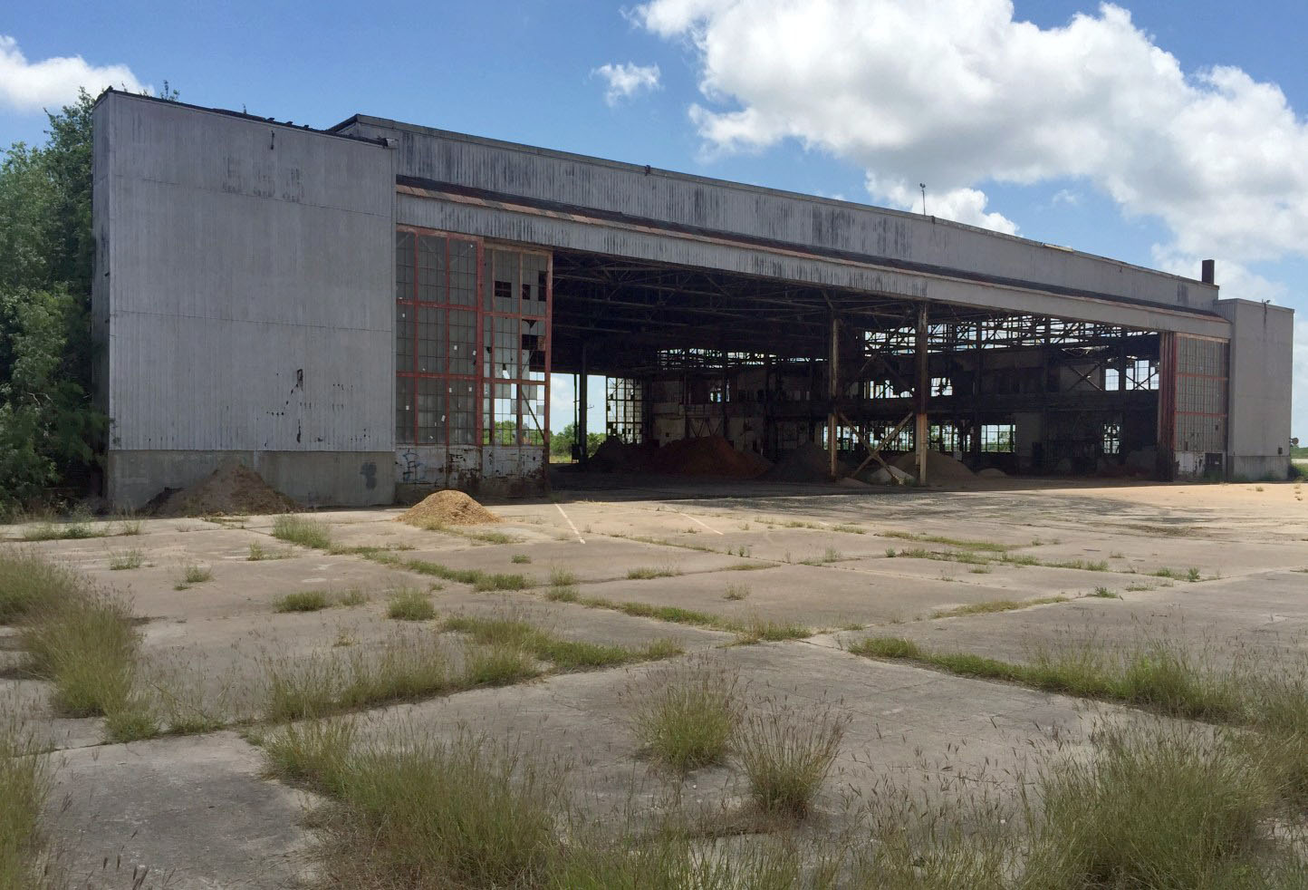
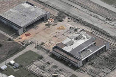
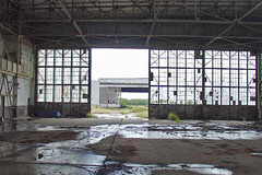
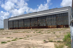
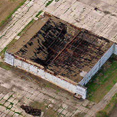
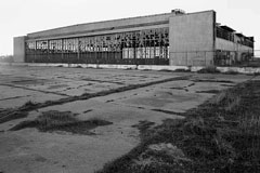
Looking south at 2 remaining hangars c. 2005 |
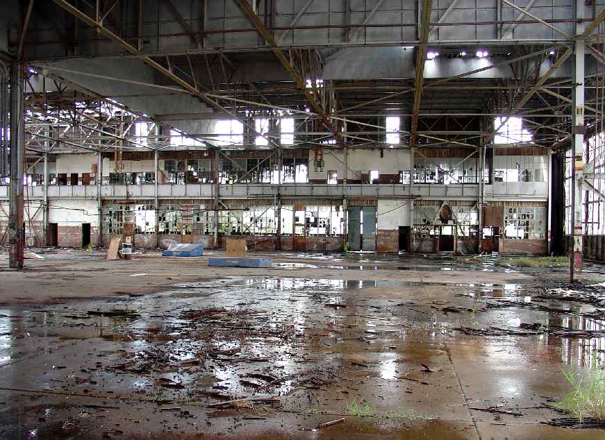
Interior of abandoned Cabaniss hangar
2007 |
Interior of abandoned Cabaniss hangar
2007 |
| |
|
|
 |
 |
 |
|
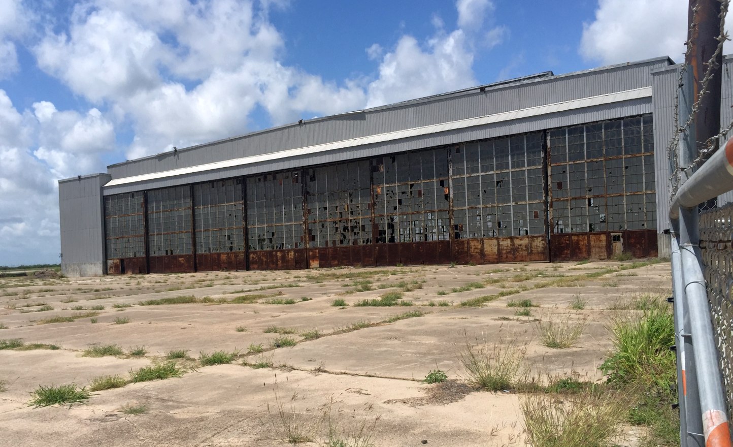
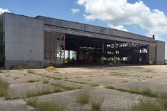
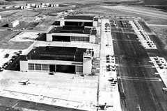
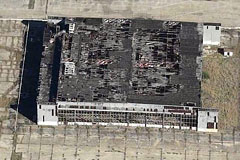
Southeastern hangar view SE Apr 14, 2017 |
Northeastern hangar view west Apr 4, 2017 |
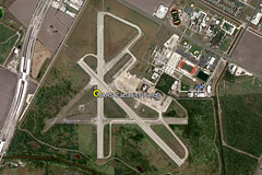
Aerial image Aug-2017 |
|
|
|
|
|
|
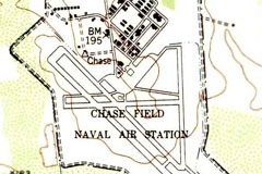
NAAS Chase Field, Beeville, Texas |
|
28.37, -97.66 (North of Corpus Christi, TX) |
|
|
 |
|
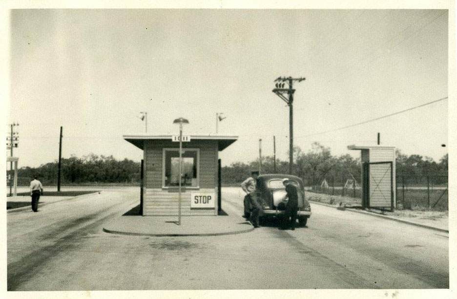
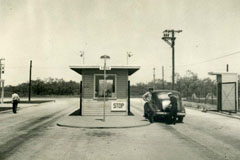
Main gate into NAAS Chase Field, ca 1943 |
|
|
 |
|
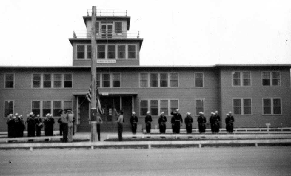
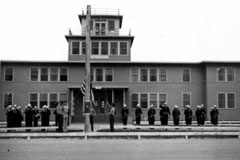
Administration building NAAS Chase, ca 1943 |
|
|
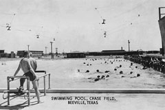 |
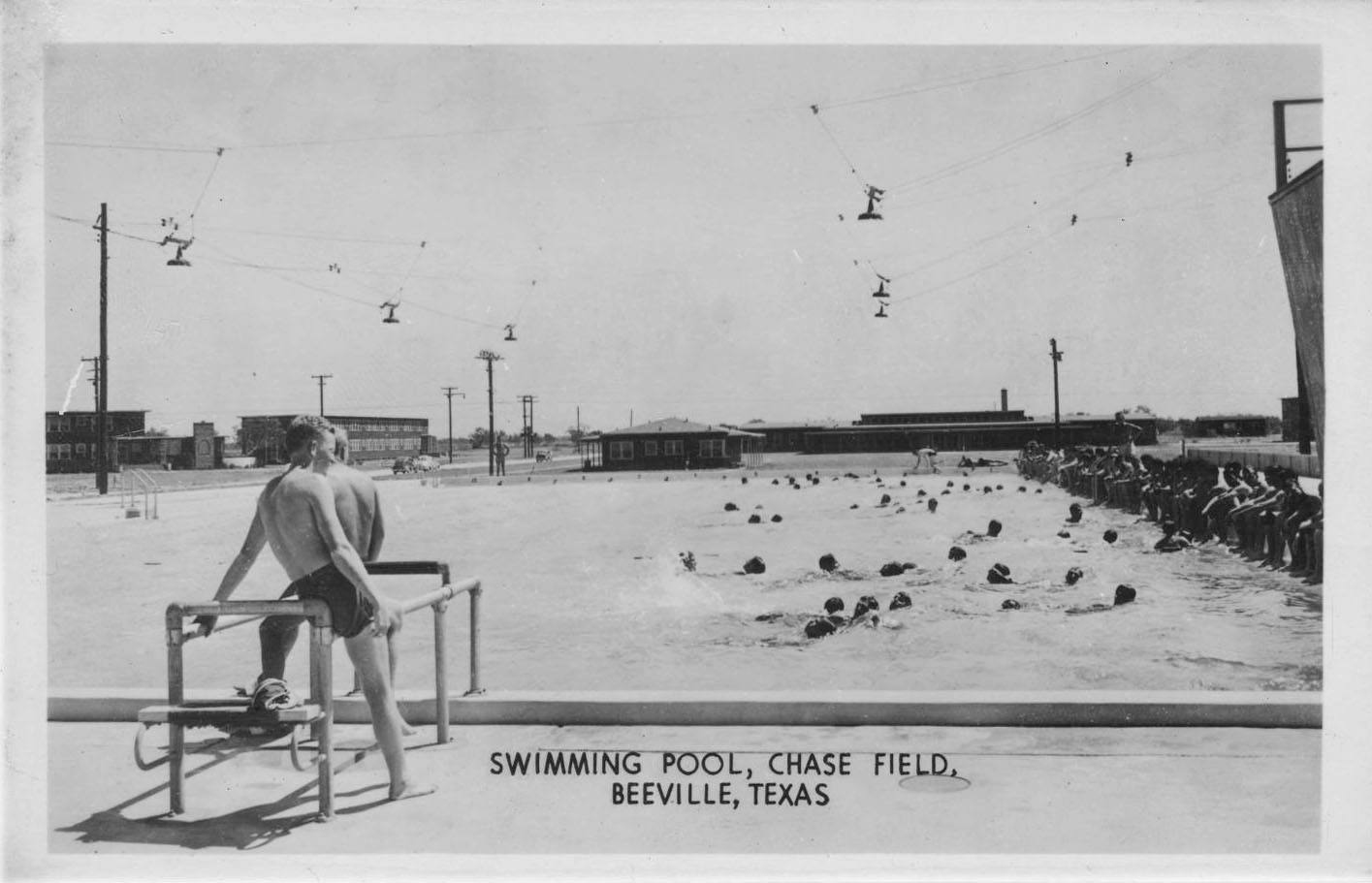
| Swimming pool at NAAS Chase Field, ca 1944 |
| |
|
|
Naval Auxiliary Air Station (NAAS) Chase
Field is a former naval air station located in
Beeville, Texas. It was named for Lieutenant
Commander Nathan Brown Chase, Naval Aviator #37,
who died in 1925 while developing carrier
landing techniques for the U.S. Navy.
Naval Auxiliary Air Station (NAAS) Chase
Field was formally commissioned in a ceremony on
June 1, 1943, before many of its buildings were
ready for occupancy. The first completed
buildings at Chase Field included quarters for
600 cadets and 1,650 enlisted men, and a
landplane hangar. Shortly afterward,
construction crews finished the administration
building and other features to support a
self-sustaining station. NAAS Chase Field was
the last and largest of auxiliary air stations
built to serve NAS Corpus Christi.
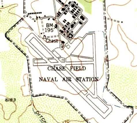
A 1945 AAF Airfield Directory described Chase
Field as a 1,064 acre irregularly-shaped
property having 3 asphalt runways, the longest
being the 4,558' north/south strip. The field
was said to have a single 91' x 20' wooden
hangar, to be owned by the City of Beeville, and
operated by the Navy.
Originally under construction as Beeville
Municipal Airport, it was leased in 1943 by the
U.S. Navy to satisfy the increasing demand for
trained pilots necessitated by World War II. Not
initially intended to be a permanent base, it
closed in July 1946.
In August 1952, it was then purchased by the
Navy to again relieve congestion at NAS Corpus
Christi in preparation for the Korean War. Jet
training began there in 1954. It operated as
NAAS Chase Field until 1968, when it was
redesignated as a full Naval Air Station (NAS)
to meet the demand for pilot training during the
Vietnam War.
Seven buildings of the station are
individually listed on the U.S. National
Register of Historic Places: NAS Chase
Field-Building 1001, Field-Building 1009,
Field-Building 1015, Field-Building 1040,
Field-Building 1042, Field-Quarters R, and
Field-Quarters S.
|
|
 |
 |
 |
|
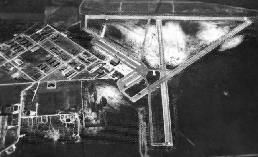
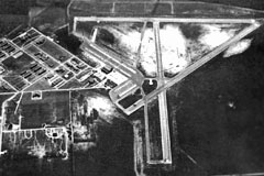
Aerial view of NAAS Chase Field in 1944 |
Sectional Chart 1945 - Chase Field, Beeville, TX |
USGS topographic map NAAS Chase Field 1954 |
|
|
|
|
|
|
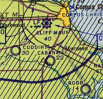
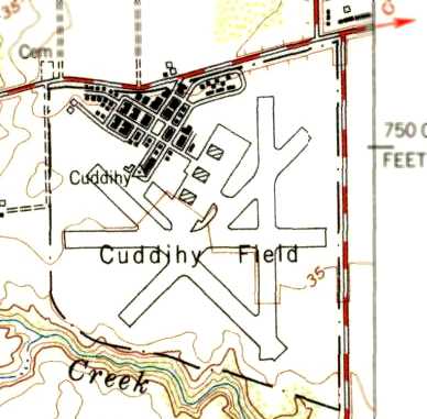
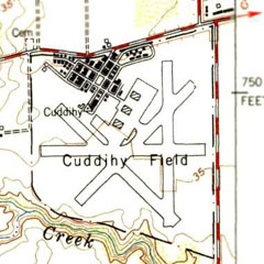
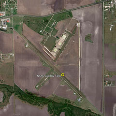
NAAS Cuddihy Field |
|
27.72, -97.51 (South of Corpus Christi) |
|
|
 |
|
Sectional Chart Feb-1943 NAAS Cuddihy Field |
|
|
 |
|
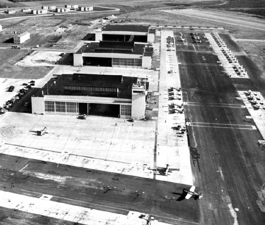
Elevated view of NAAS Cuddihy Field 1944 |
| |
| |
 |
|
NE view of hangars at
Cuddihy Field, ca 1943 |
|
|
 |
|
NE view of hangars removed, ca 2017 |
|
|
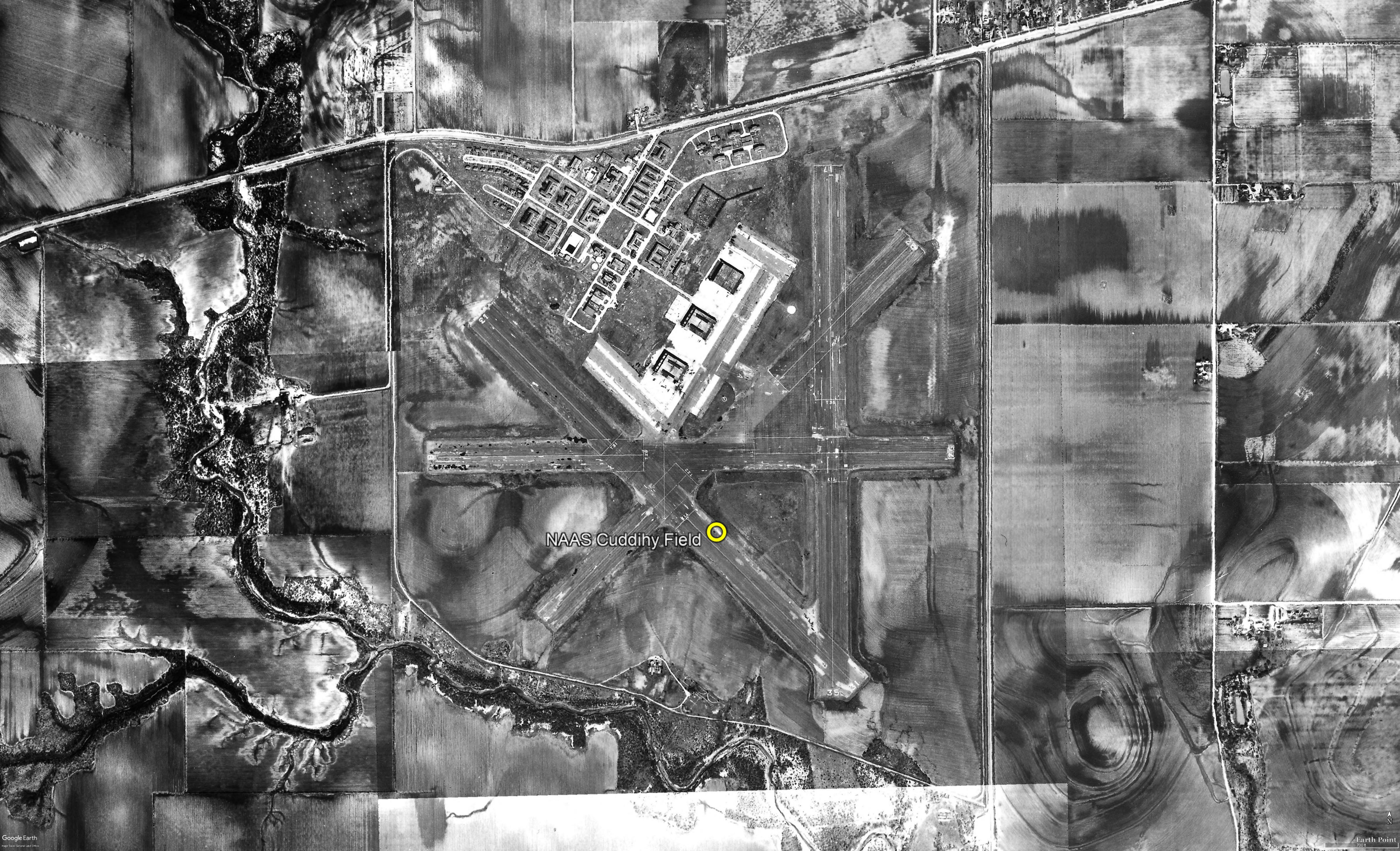
This airfield was used during WW2 as one of 3
satellite fields for Corpus Christi NAS, which
conducted primary & advanced flight training for
American cadets & those of several foreign
countries. The date of construction of Cuddihy
Field has not been determined. It was not yet
depicted on the June 1941 Corpus Christi
Sectional Chart. The earliest depiction which
has been located of Cuddihy Field was a 1941
aerial view looking northeast. It depicted
Cuddihy as having 4 asphalt runways, a large
paved ramp area on the north side with 3 large
hangars, and a housing area with buildings north
of the hangars.
The earliest aeronautical chart depiction of
Cuddihy Field which has been located was on the
February 1943 Corpus Christi Sectional Chart.
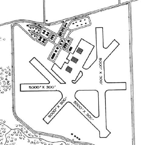
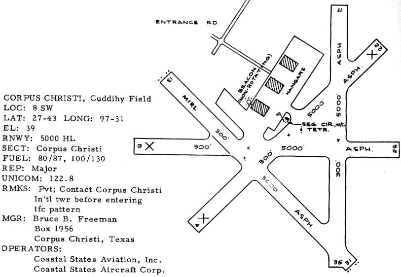
The 1945 AAF Airfield Directory described
Cuddihy Field as an 803 acre irregularly-shaped
field having 4 asphalt 5,000' runways. The field was described as having 3 steel 96'
x 28' hangars.
NAAS Cuddihy Field was listed as having a
total of 7 outlying fields.
| 27221 NOLF #30 (6 mi W) |
|
26426 NOLF #34 (12 mi WSW) |
| 28523 NOLF #31 (7.9 mi NW) |
|
28131 NOLF #35 (16 mi WNW) |
| 27325 NOLF #32 (10 mi W) |
|
26832 NOLF #36 (17 mi W) |
| 28327 NOLF #33 (11 mi WNW) |
|
|
Cuddihy was closed at an unknown date after
WW2. It was used for a few months in 1947 as the
temporary campus of the Arts & Technological
College (later to become Texas A & M University
at Corpus Christi). In 1947, the city of Corpus
Christi assumed operation of Cuddihy Field, and
it began to be used as a civil airport. Most
private aircraft were moved from Corpus
Christi's Cliff Maus Airport to Cuddihy Field in
1947. The 1949 Corpus Christi Sectional Chart
(courtesy of Chris Kennedy) described Cuddihy
Field as having a 5,000' hard-surface runway & a
control tower.
The 1954 USGS topo map depicted Cuddihy Field
as having 4 paved runways, 3 hangars, and a
large number of buildings.
A March 4, 1956 aerial view depicted at least 4
aircraft on the ramp at Cuddihy Field. The
runways appeared to be painted with markings
subdividing them into aircraft carrier practice
outlines.
Cuddihy had become a private airfield by
1963, as that is how it was listed in the 1963
TX Airport Directory. It depicted Cuddihy as
having 2 of the 4 original runways still
maintained. The operators were listed as Coastal
States Aviation Inc. & Coastal States Aircraft
Corp. The last photo which has been located
showing aircraft at Cuddihy Field was a 1968
aerial view, which showed 5 light single-engine
aircraft parked near the southwestern hangar,
and all 4 runways remained intact, although
deteriorated.
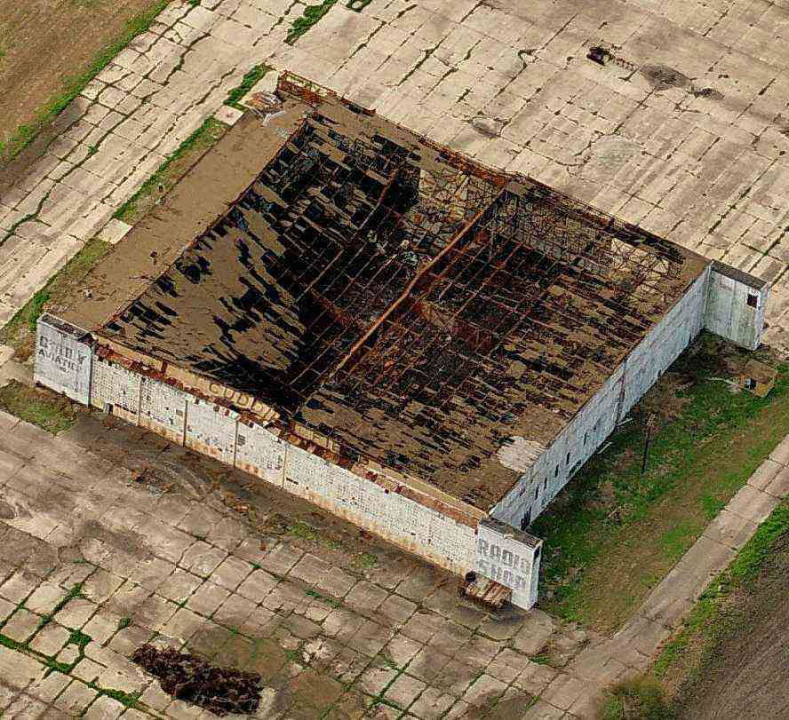
Below is a circa 2006 aerial view looking
south at the northern-most of Cuddihy's three
hangars, with majority of roof collapsed.
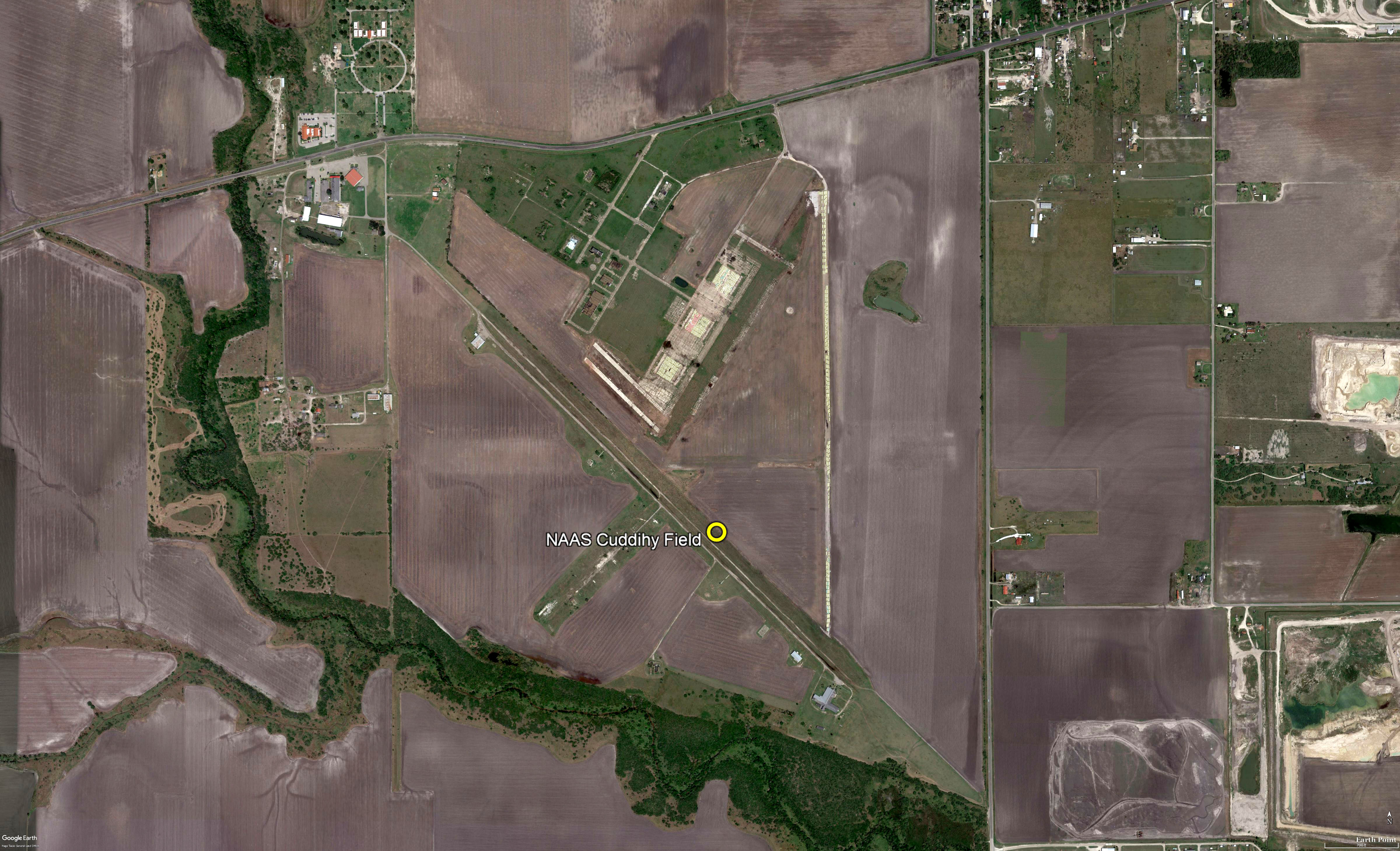
As of 2008, Cuddihy Field Airport was still listed as an
active private airfield, with a single 5,000 asphalt
Runway 13/31.
History courtesy of
website:
Abandoned & Little-Known Airfields
|
|
|
|
|
|
 |
 |
 |
| Diagram from
1945 AAF Airfield Directory |
1954 USGS
topographic map of Cuddihy Field |
Aerial photo
of Cuddihy from Dec-1956 |
|
|
|
|
 |
 |
 |
| A private
airfield in 1963 Texas Airport Directory |
Looking south
at Cuddihy's north hangar c 2006 |
Aerial image
of Cuddihy from Aug-2017 |
|
|
|
|
|
|
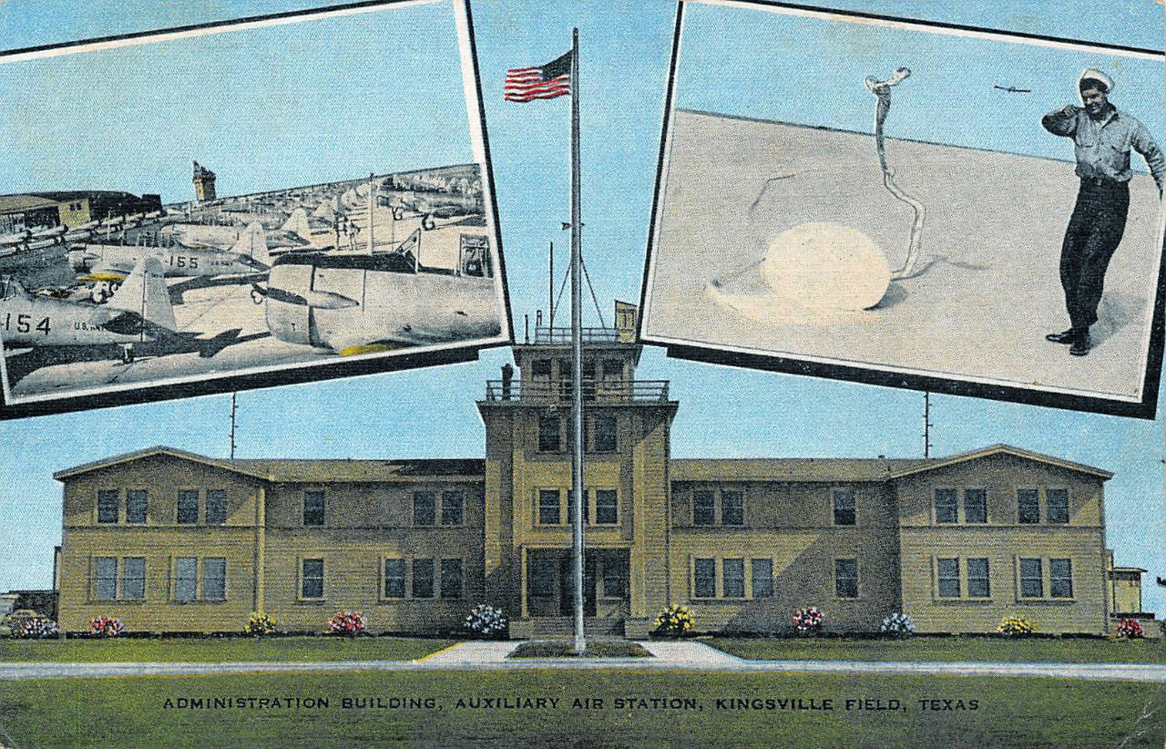
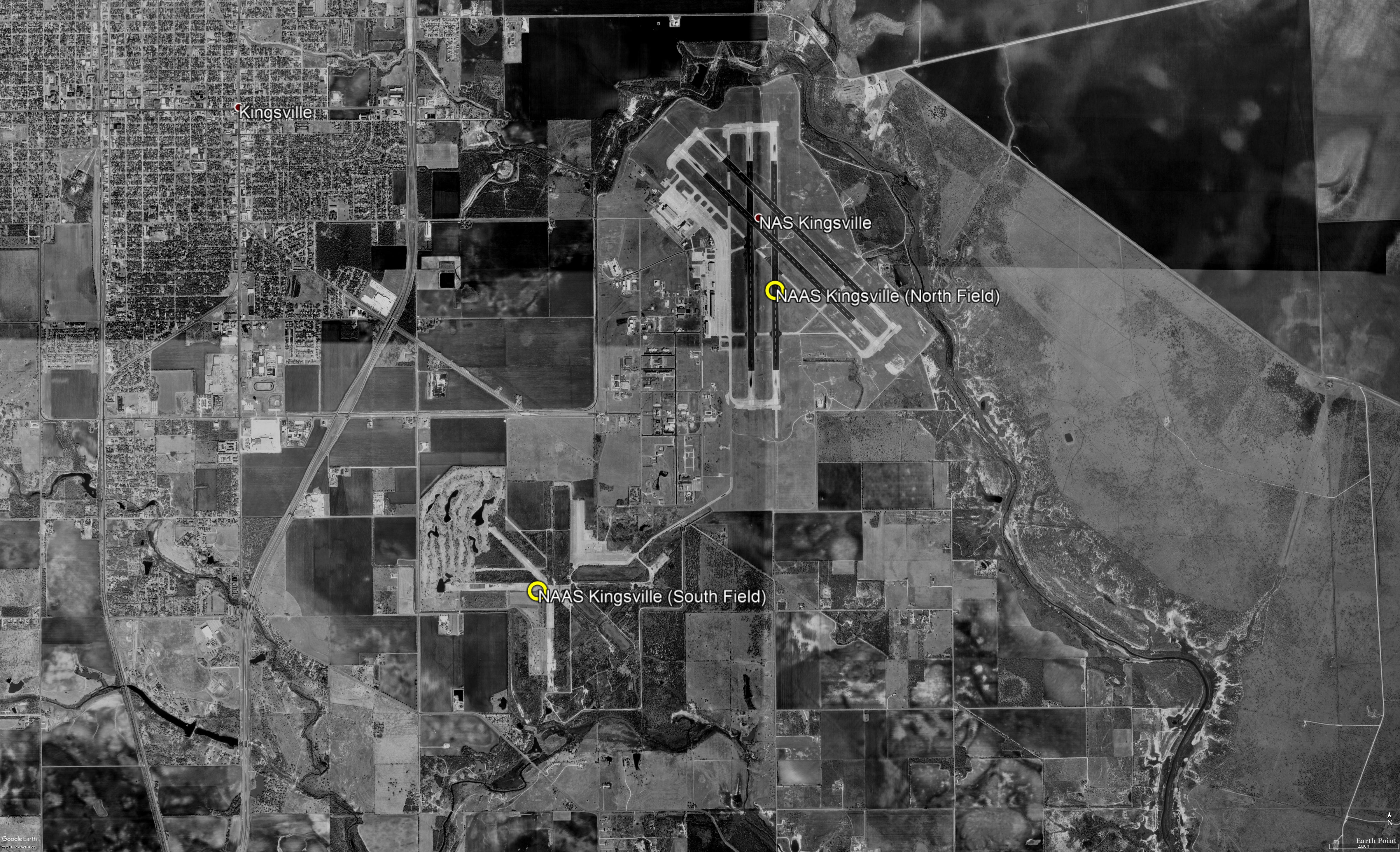
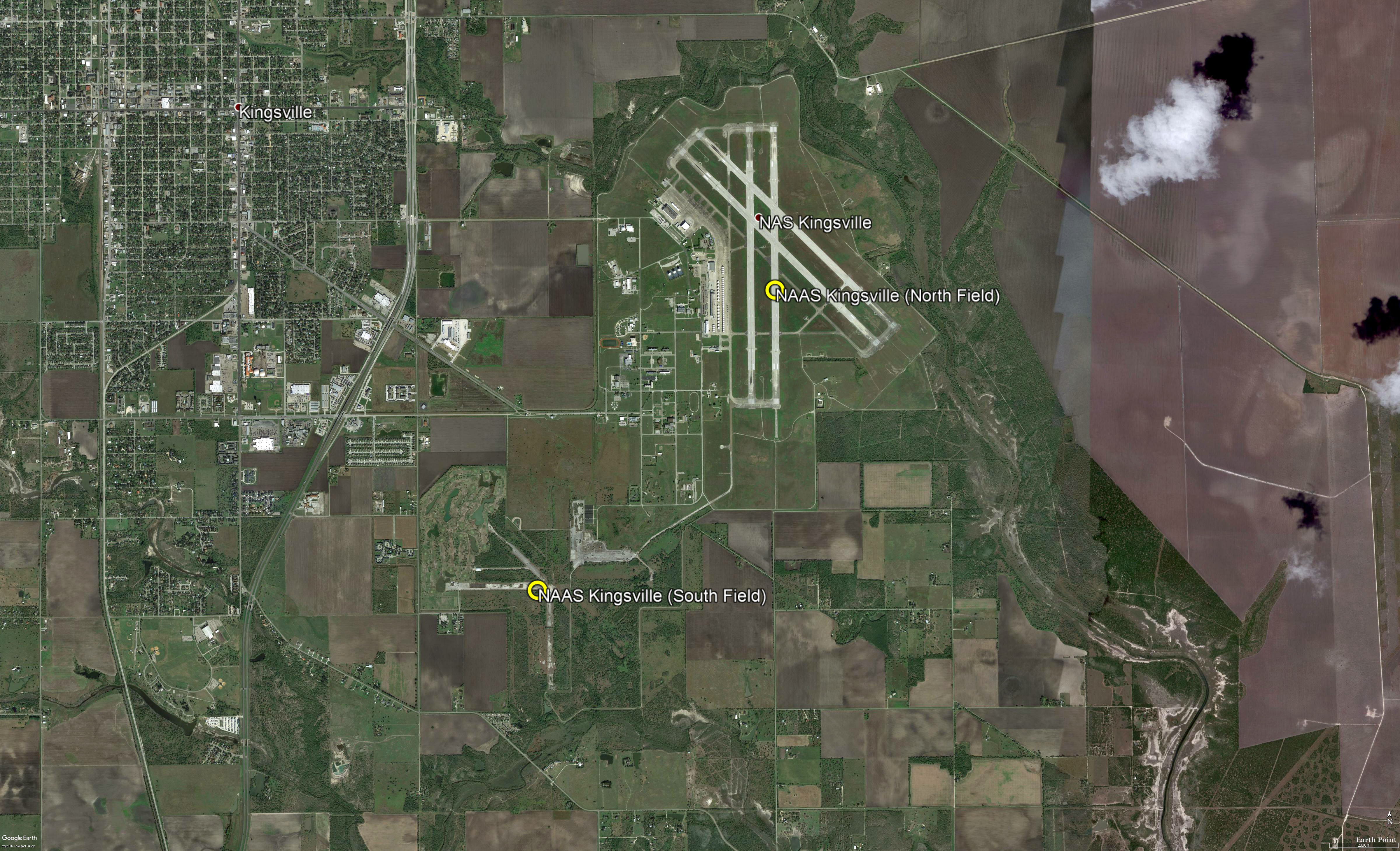
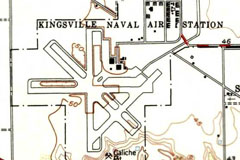
NAAS Kingsville Field (North & South) |
|
27.48, -97.83 (Southwest of NAS Corpus Christi) |
|
|
 |
|
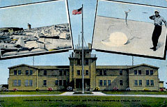
Postcard of NAAS Kingsville administration
building |
|
|
 |
|
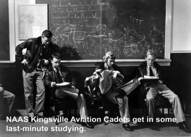
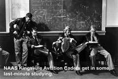
Cadets in classroom at NAAS Kingsville ca. 1944 |
|
|
 |
|
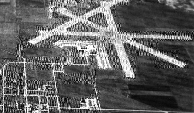
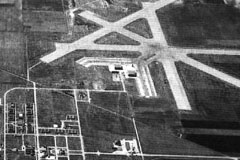
NAAS Kingsville, TX (South Field) in 1944 |
|
|
 |
|
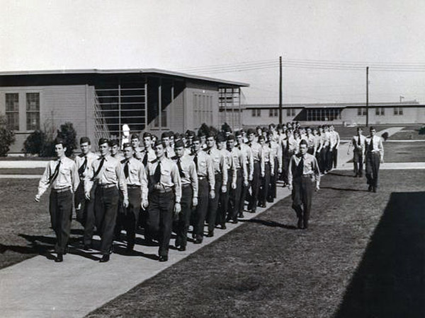
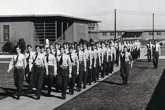
Cadets marching at NAAS Kingsville in 1945 |
|
|
 |
|
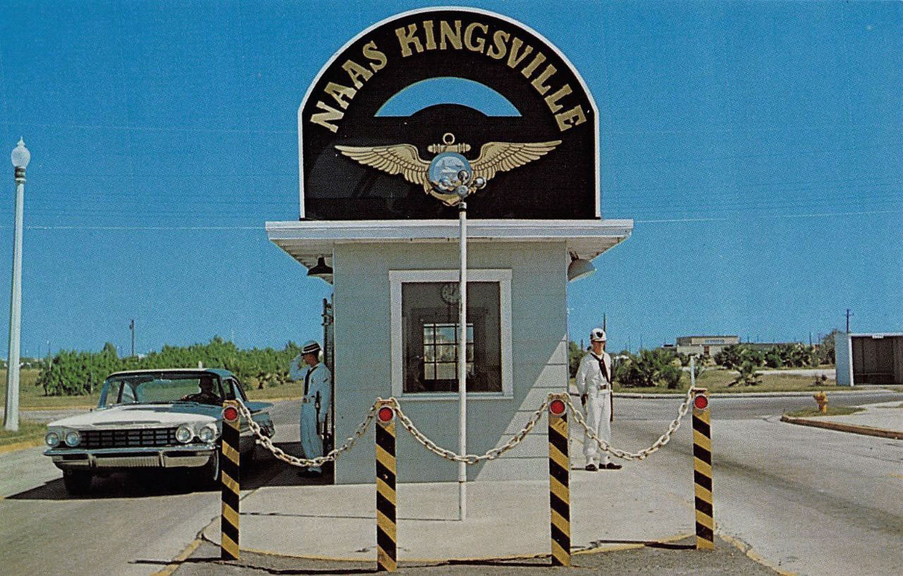
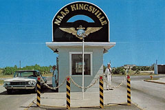
Entrance gate to NAAS Kingsville in 1960 |
|
|
The bombing of Pearl Harbor on Dec. 7, 1941,
prompted the Navy to purchase a 3000 acre
tract of farmland for a new auxiliary air station,
located some 3 miles east of Kingsville in
Kleberg County, Texas.
On July 4, 1942, Naval Air Auxiliary Station
(NAAS) Kingsville Field was commissioned, and CDR D. S. McMahon assumed command. It
was one of seven auxiliary air stations for
Naval Air Technical Training Command (NATTC)
headquartered at NAS Corpus Christi.
NAAS Kingsville Field had a
total of 7 naval outlying landing fields (NOLFs), some
of which were shared
with other auxiliary stations within NAS Corpus Christi.
| 23416 NOLF #11 |
|
24024 NOLF #25 |
|
20115 NOLF #42 |
| 23521 NOLF #13 |
|
20410 NOLF #41 |
|
22441 NOLF #55 |
| 26117 NOLF #21 |
|
|
|
|
A combination of two airfields
with barracks and other station activities in a
central location were built, thus saving on construction
time. Many of the structures were designed as
temporary buildings with no plans to operate the
air
facility once the war was over.
Over the next three years, NAAS Kingsville
Field played an important role in training Navy
and Marine Corps aviators and aerial gunners for
the fleet during World War II. Pilots received training in carrier dive
bombing tactics, anti-submarine warfare, and
cockpit gunnery and artillery at both North and
South Fields.
In 1968, the airfield was redesignated as
Naval Air Station Kingsville, and has hosted
flight training operations throughout its
existence.
Kingsville Field 1940's Timeline during WWII
|
Jul 23, 1942 |
|
Recruit training added to command mission due to
overcrowding at Recruit Training Command (RTC) Great Lakes, Ill. |
|
Nov 1, 1942 |
|
First gunnery department crew reports aboard. |
|
Nov 4, 1942 |
|
LCDR Troy Thweatt assumes command of NAAS Kingsville
Field. |
|
Dec 7, 1942 |
|
Enlisted aviation personnel become the first
aerial-free gunners to enroll in classes at NAAS Kingsville. The
two-week course included primary instruction in trap and skeet shooting,
and machine gun stripping, firing, and sighting. A similar school was
created for aviation cadets. |
|
Jan 15, 1943 |
|
Seaman Guard organized to take care of all security
guard duties on station. |
|
Apr 1, 1943 |
|
The Bureau of Naval Personnel decides to move the Free
Gunnery Training Unit from Corpus Christi to Kingsville. |
|
Jun 30, 1943 |
|
Training Squadron 14C begins operations. |
|
|
|
Secretary of the Navy Frank Knox visits the air field. |
|
Jul 7, 1943 |
|
President F.D. Roosevelt and Mexican President Manuel
Ávila Camacho visit Kingsville Field. |
|
Jan 5, 1944 |
|
Station Chapel is named in honor of NAAS Kingsville’s
first command chaplain, LT J. William McFall, who served on board from
Dec. 28, 1942 to May 17, 1943. He was killed in action on Dec. 12, 1943,
while serving in the Pacific. |
|
Feb 16, 1944 |
|
CDR H. C. Doan assumes acting command of the air field
from LCDR Troy Thweatt. |
|
Jun 4, 1944 |
|
CDR H. V. Morrison assumes command of the air field
from CDR H. C. Doan. |
|
Sep 15, 1946 |
|
Navy places NAAS Kingsville Field in caretaker
status. Land is leased to the city of Kingsville and Texas A & I College. |
From: Naval Air Station
Kingsville History. Retrieved May 31, 2018, from
https://www.cnic.navy.mil/regions/cnrse/installations/nas_kingsville/about/history/1940s.html
|
|
|
 |
 |
 |
|
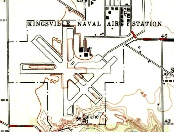
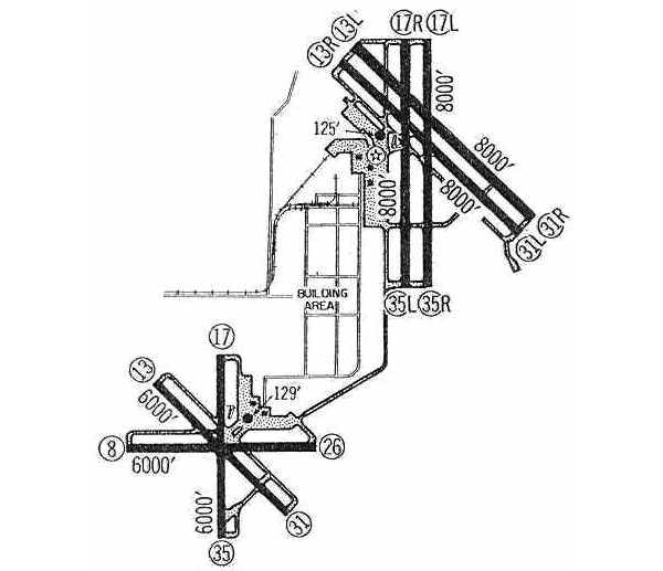
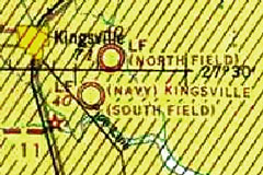
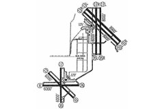
1943 Chart of Kingsville's North & South fields |
1954 USGS topographic map of South Field |
North & South Fields of NAAS Kingsville in 1960 |
|
|
|
|
 |
 |
 |
|
Aerial photo of North & South Fields Jan-1996 |
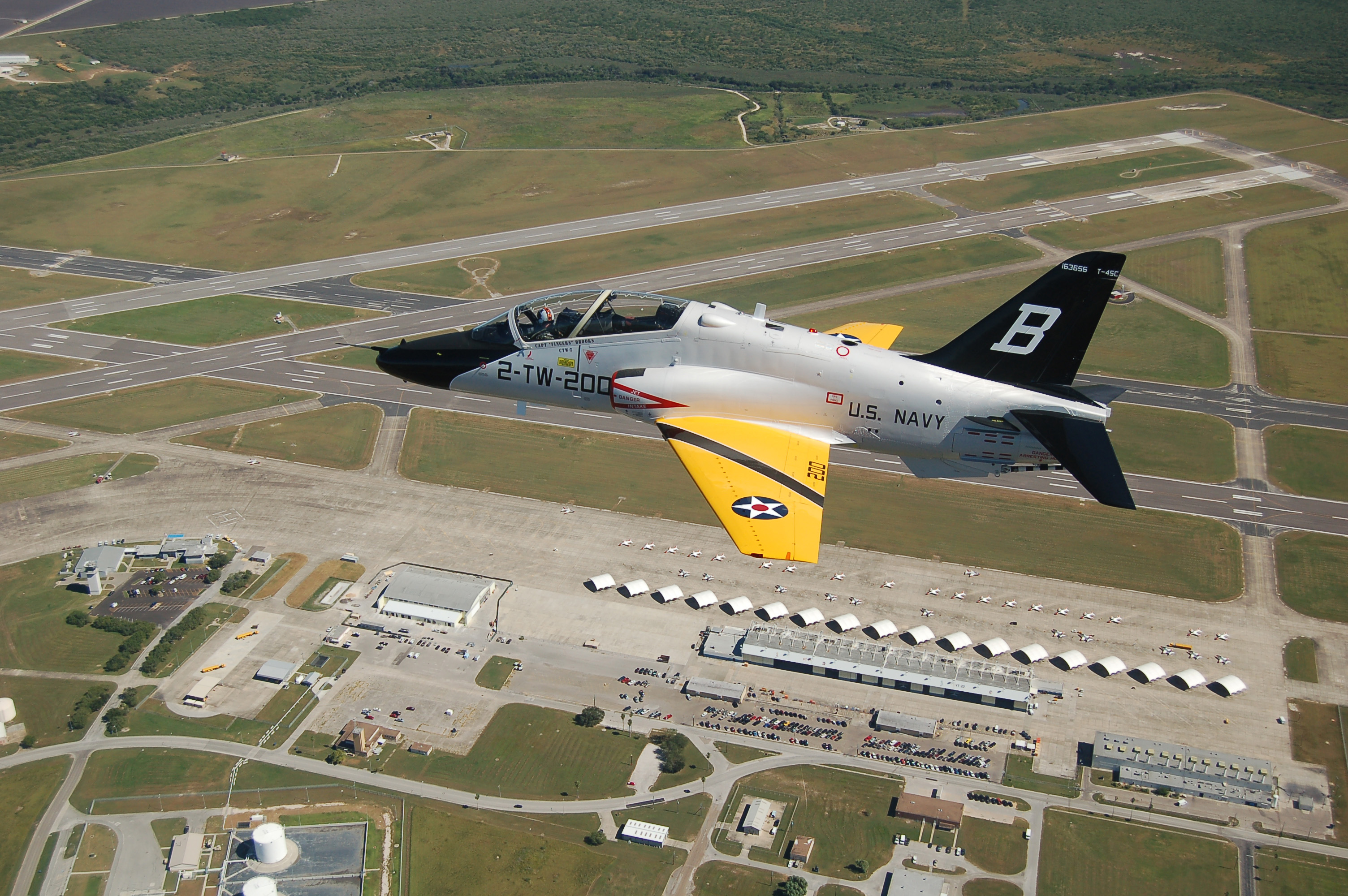
T-45C Goshawk navy trainer in pre-WWII colors
flies over NAS Kingsville Oct-2010 |
Aerial photo of North & South Fields Aug-2017 |
|
|
|
|
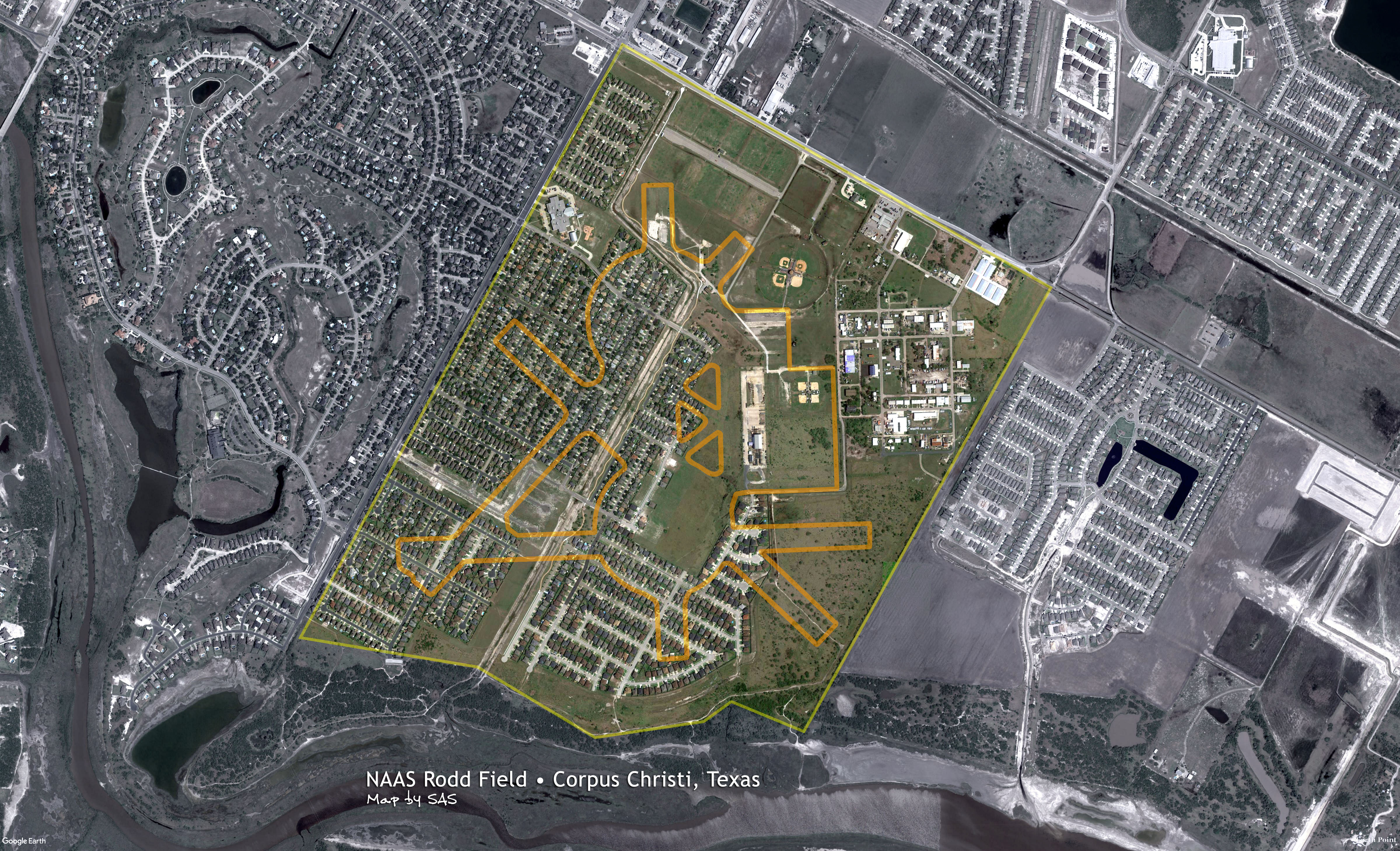
NAAS Rodd Field |
|
27.65, -97.38 (Southeast of Cabaniss) |
|
|
 |
|
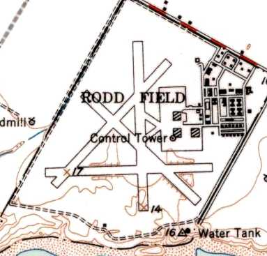
NAAS Rodd Field aerial view 19-Aug-1941 |
|
|
 |
|
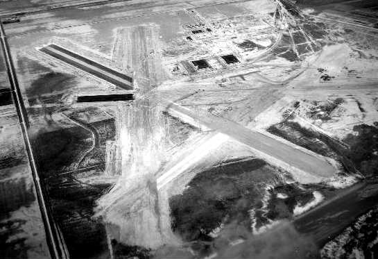
Aerial view of hangars looking north in 1942 |
| |
 |
| Stearman trainers on ramp and circle mat
beyond |
| |
 |
|
A very busy primary flight training field in 1942 |
|
|
 |
|
Hangars and ramp looking southeast 1942 |
|
|
 |
|
A 1944 view of Rodd Field looking northeast |
|
|
 |
|
A 2002 image of Rodd Field's last hangar |
|
|
 |
|
A 2005 aerial view of hangar before its removal |
|
|
|
|
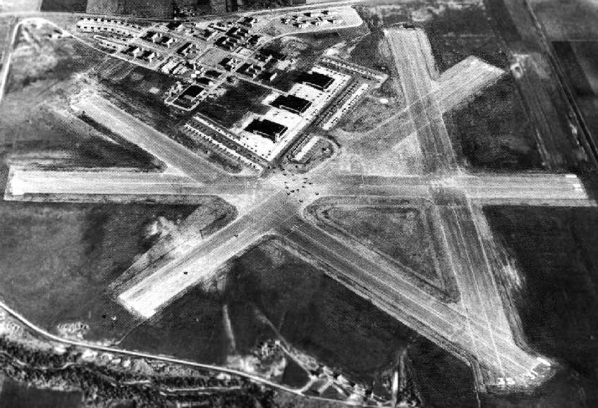
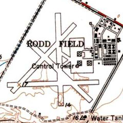
The federal government acquired 861 acres on
this site in 1940, and activated Rodd Field in
1941. Rodd Field was used for Naval Cadet flight
training, and as an auxiliary landing field for
the nearby Naval Air Station Corpus Christi.
The earliest depiction of Rodd Field was a
8/19/1941 aerial view. The photo shows Rodd
Field during its primary training days in
original airfield configuration, with two large
circular asphalt landing mats, and a ramp with
two hangars on the east side. The photo shows
several dozen Navy trainers on the ramp, and a
stream of several heading out onto the landing
mat. There were no runways at first, only the
two landing mats. The airfield would later
expand to include four paved runways, taxiways,
ramp area, three hangars, and a street grid with
a total of 75 buildings on site.
NAAS Rodd Field was listed as having a total
of 9 naval outlying landing fields.
| 24311 NOLF #1A (3.1 mi SW) |
|
23416 NOLF #11 (7.6 mi SW) |
| 22514 NOLF #1B (6.5 mi WSW) |
|
22521 NOLF #14 (14 mi SW) |
| 21811 NOLF #1C (5 mi S) |
|
24025 NOLF #25 (17 mi WSW) |
| 22215 NOLF #1D (8.5 mi SSW) |
|
03022 NOLF (4.5 mi N of Rockport,
TX) |
| 22912 NOLF #10 (5 mi SSW) |
|
|
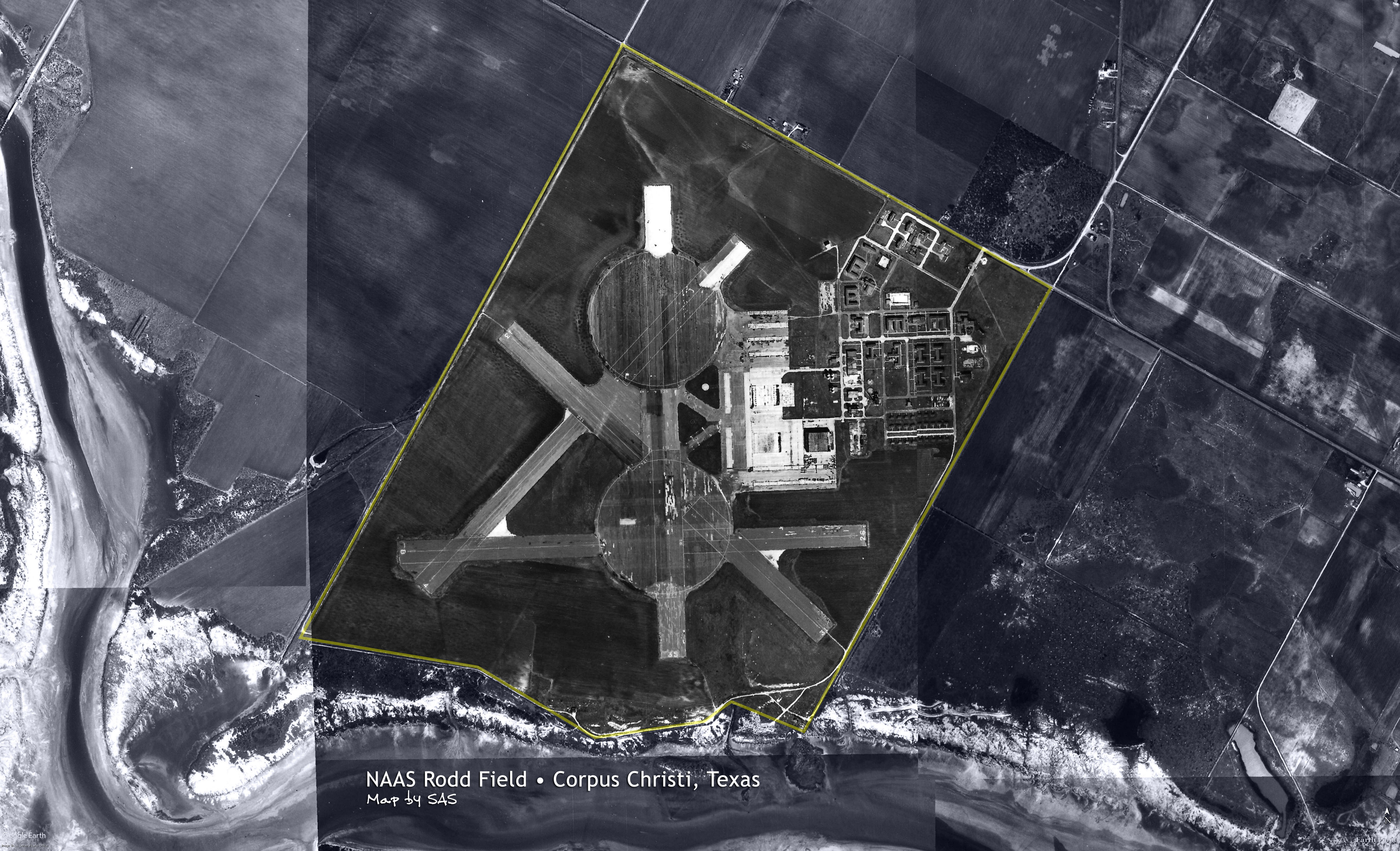
A 1951 USGS topographic map indicates Rodd
Field as having 4 paved runways, 3 hangars, a
control tower, and numerous buildings. A 1/22/69
article from The Beehive (courtesy of Ford
Lauer) said that 2 hangars were relocated from
Rodd Field to Chase Field in 1954.
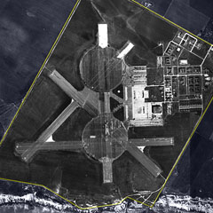
Rodd Field appeared to have been closed by
the time of a 3/4/56 aerial view, as no aircraft
were visible on the field, and 2 of the 3
hangars had been removed. The runways remained
intact, consisting of 4 paved runways along with
2 giant circular landing pads.
The precise date of closure of Rodd Field has
not been determined, but the property was
declared excess in 1958. The General Services
Administration sold portions of the Rodd Field
property to several private parties in 1960. The
March 1960 Corpus Christi Sectional Chart
depicted Rodd as “Abandoned Airfield”.
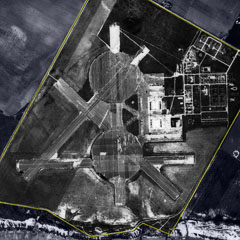
A 1961 aerial view showed no significant
change in the Rodd Field remains. GSA
transferred 136 acres of the northern portion of
the base to NASA in 1964, which established the
Texas Manned Space Flight Network Tracking
Station at the site. The Texas MSFN Tracking
Station opened in 1967, and was operated by the
Bendix Field Engineering Corporation. The
station's administrative offices were located in
the last former Navy hangar, referred to as the
main operations building. In addition to the
administration offices, the hangar housed
telemetry systems, command system, computers,
and other communications equipment. Located
about one mile south of the hangar was the VHF
Acquisition Aid equipment. The Unified S-Band
system & power generating equipment were located
a half mile north of the hangar. During the
Apollo Program, this Texas station acted as a
remote station, remoting telemetry data,
tracking information, and voice communications
to MCCH in Houston. The station also acted as an
uplink facility between the lunar vehicles & the
MCCH Control Center. By the time of the July
1969 Brownsville Sectional Chart, the airfield at Rodd was no
longer depicted at all.
The NASA facility was closed by 1974, at
which point their property was transferred back
to GSA. The 1975 USGS topo map no longer
depicted any runways on the property (just one
remaining hangar), and labeled the property as
“NASA tracking facility”. Tom Harper recalled,
“I was assigned to the Corpus Christi Army Depot
from 1975-78 and we were using the hangar on
Rodd Field to store helicopter components
awaiting repair & return to service. The hangar
was in bad condition at the time. The NASA
building was still there & should been saved as
part of our space program history.”
The July
1979 Brownsville Sectional Chart no longer depicted Rodd Field, not
even as an abandoned airfield. A 1979 aerial
view showed most of Rodd's runway pavement had
been removed, but the outlines of the runways
were still plainly recognizable.
The Rodd
Field property was conveyed in 1980 to the City of
Corpus Christi, which built Bill Witt Park. The
park still exists today on that part of the
property. The 1984 USGS topo map labeled the
property as “Radio facility”. A 1985 aerial view
showed the outlines of the runways were still
plainly familiar. The City of Corpus Christi
acquired 175 acres along the southern periphery
of the airfield 1987-1988, which became Oso
Creek Park. A 1990 aerial view showed a housing
development had been built over the northwest
portion of the old runways.
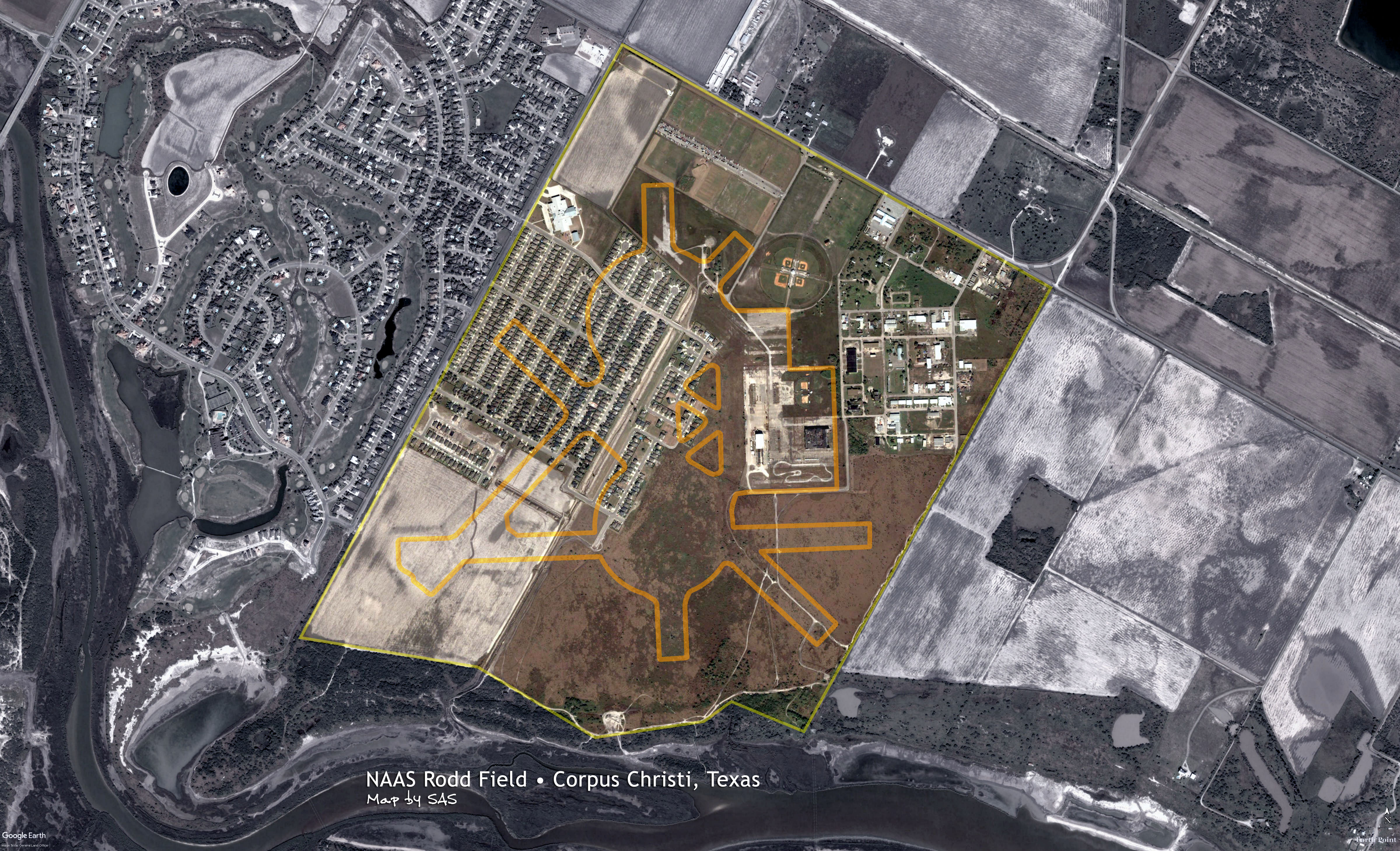
A visit to the site in 2001 by Jeffery
Sternberg provided an update of the status of
Rodd Field. Most of the ramp area also still existed,
as well as one of the three hangars (then in an
advanced state of deterioration). The street
grid and several small concrete buildings still
existed. Most of the runways had been removed,
with the exception of an 800 foot segment of the
east/west runway (visible as a white line in the
1995 USGS aerial photo, north of the baseball
diamonds), which was currently used as a parking
lot for the recreational field. The control tower
still existed, just south of the remaining runway
segment.
A 2005 aerial photo shows the sole
remaining hangar at Rodd. An aerial photo from
2006 showed the deteriorated hangar remained
standing. Finally, a 2008 aerial view showed that Rodd's
last hangar had been removed.
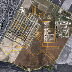
A 2017 Google satellite view shows Rodd
Field's western half mostly overtaken by
single-family housing. However, the
auxiliary air station's old street grid and a few buildings
are still noticeably visible, along with some of
its original paved ramps on the eastern half of
the site.
Rodd Field was once a very active naval
auxiliary air station built just before the
Pearl Harbor attack in 1941. It, and many other
WWII training airfields, represents how much of
what the country was then capable of achieving
in such little time.
|
|
 |
 |
 |
|
Diagram from 1945 AAF Airfield Directory |
1951 USGS topographic map of NAAS Rodd Field |
Aerial photo of Rodd Field from Dec-1956 |
| |
|
|
 |
 |
 |
|
Aerial photo of Rodd Field from Dec-1961 |
Aerial photo of Rodd Field from Dec-2002 |
Aerial photo of Rodd Field from Aug-2017 |
|
|
|
|
The Servicemen's Readjustment Act of 1944 (G.I.
Bill)
|
|
Also known as the G.I. Bill, the law provided a
range of benefits for returning World War II
veterans (commonly referred to as G.I.s). It was
designed by the American Legion, who helped push it
through Congress by mobilizing its chapters (along
with the Veterans of Foreign Wars); the goal was to
provide immediate rewards for practically all World
War II veterans.
Benefits included dedicated payments of tuition
and living expenses to attend high school, college
or vocational/technical school, low-cost mortgages,
low-interest loans to start a business, as well as
one year of unemployment compensation. It was
available to all veterans who had been on active
duty during the war years for at least 90 days and
had not been dishonorably discharged—exposure to
combat was not required. The recipients did not pay
any income tax on the GI benefits, since they were
not considered earned income.
By 1956, roughly 7.8 million veterans had used
the G.I. Bill education benefits, some 2.2 million
to attend colleges or universities and an additional
5.6 million for some kind of training program.
|
|
|
|
|
General Note
|
|
Majority of information is
courtesy of historical aviation website
Abandoned & Little-Known Airfields
(Please consider donating to ALKA) |
|
|
References
|
| • |
Freeman, P. (2018, May 25).
Texas: Western Corpus Christi area. Retrieved May
25, 2018, from http://www.airfields-freeman.com/ |
| • |
Moore, Myers, Goebel, and Nicklaus (March 30,
1994). "National Register of Historic Places
Multiple Properties Documentation: Historic and
Architectural Resources of Naval Air Station Chase
Field, Beeville Vicinity, Bee County, Texas".
Retrieved June 1, 2018. |
| • |
Naval Air Station
Kingsville History. Retrieved May 31, 2018, from http://www.cnic.navy.mil |
| |
|
|
|
|